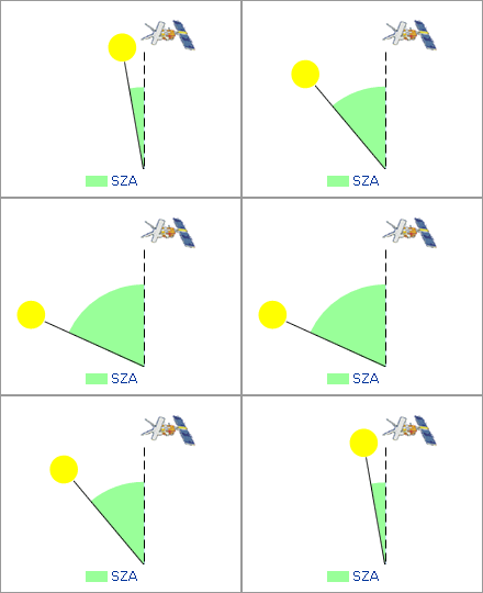
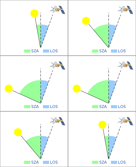
Here are two representations of the light path from the sun to the satellite in nadir mode viewing. Answer the two questions, considering only reflection from the ground and ignoring refraction or scattering in the atmosphere.

Fig e1: Nadir LOS, changing SZA Image AT2-ELS |
How does the light path and the thickness of the absorption layer vary in relation to the solar zenith angle, SZA? AMF = _ |

Fig e2: Oblique LOS, changing SZA Image AT2-ELS |
How does the light path vary if the satellite is pointing at an angle to the nadir, LOS? AMF = _ |
How to enter mathematical expressions in exercise gaps
| General | Spaces inside and outside expressions and the case of characters will usually be ignored. |
| Symbols | Use * for multiplication and / for division. Use ° or deg for degrees. Use conventional function abbreviations, e.g. cos, rad etc. |
| Decimals | E.g. 3.15, 0.02. Use only . for a decimal point. The number of decimal places to be entered will normally be stated in the exercise, if not enter the minimum reasonable number of decimal places. |
| Powers | Enter e.g. 3-2 in the form 3^-2. Enter 3·10-2 as 3E-2 or 3*10^-2. |