
Combined MODIS - AMSR-E Sea Ice Maps
Because of the high volume of MODIS data, only regional maps can be calculated.
For your specific needs, more regions may be defined and daily calculated, please contact Georg Heygster
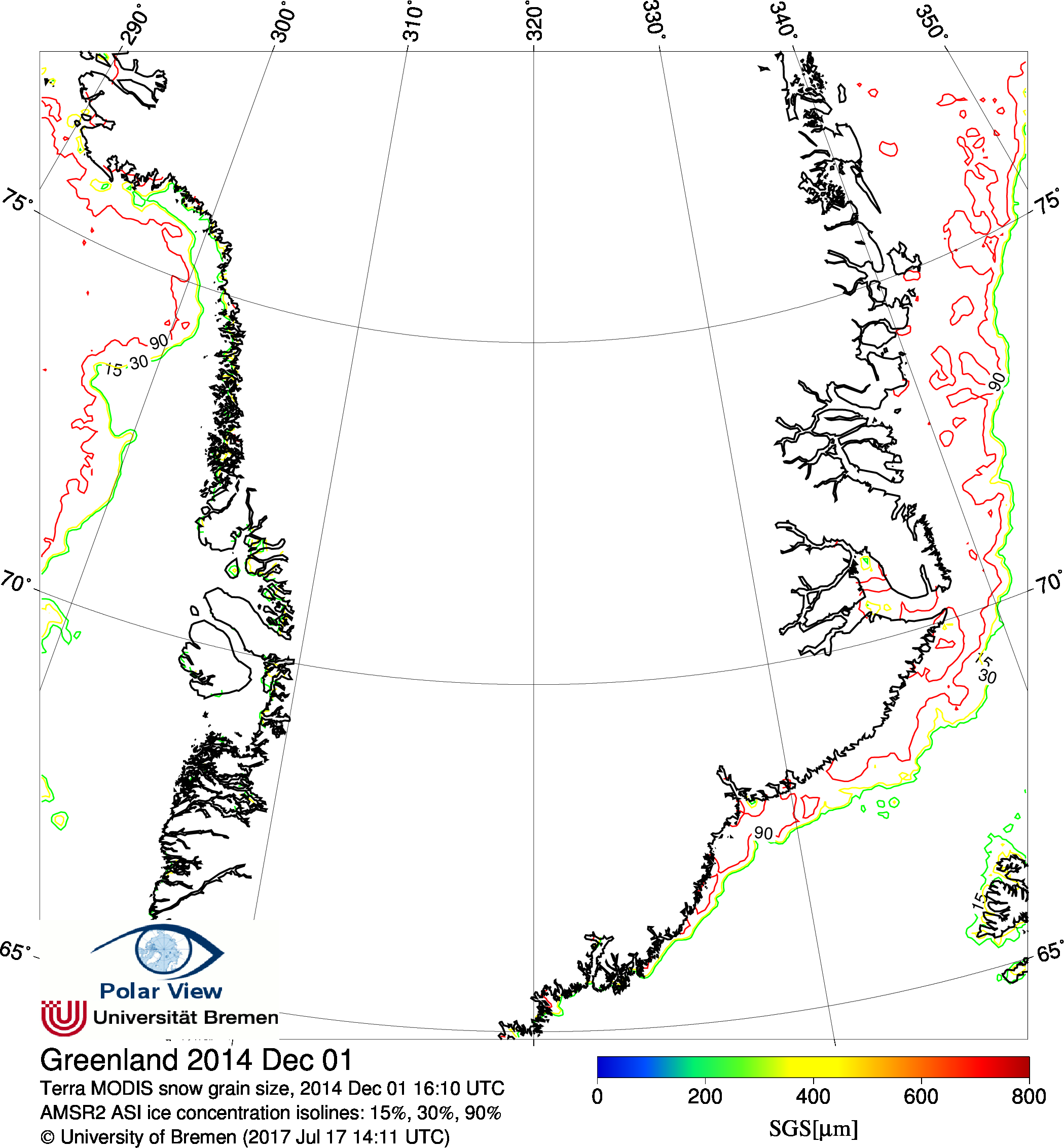
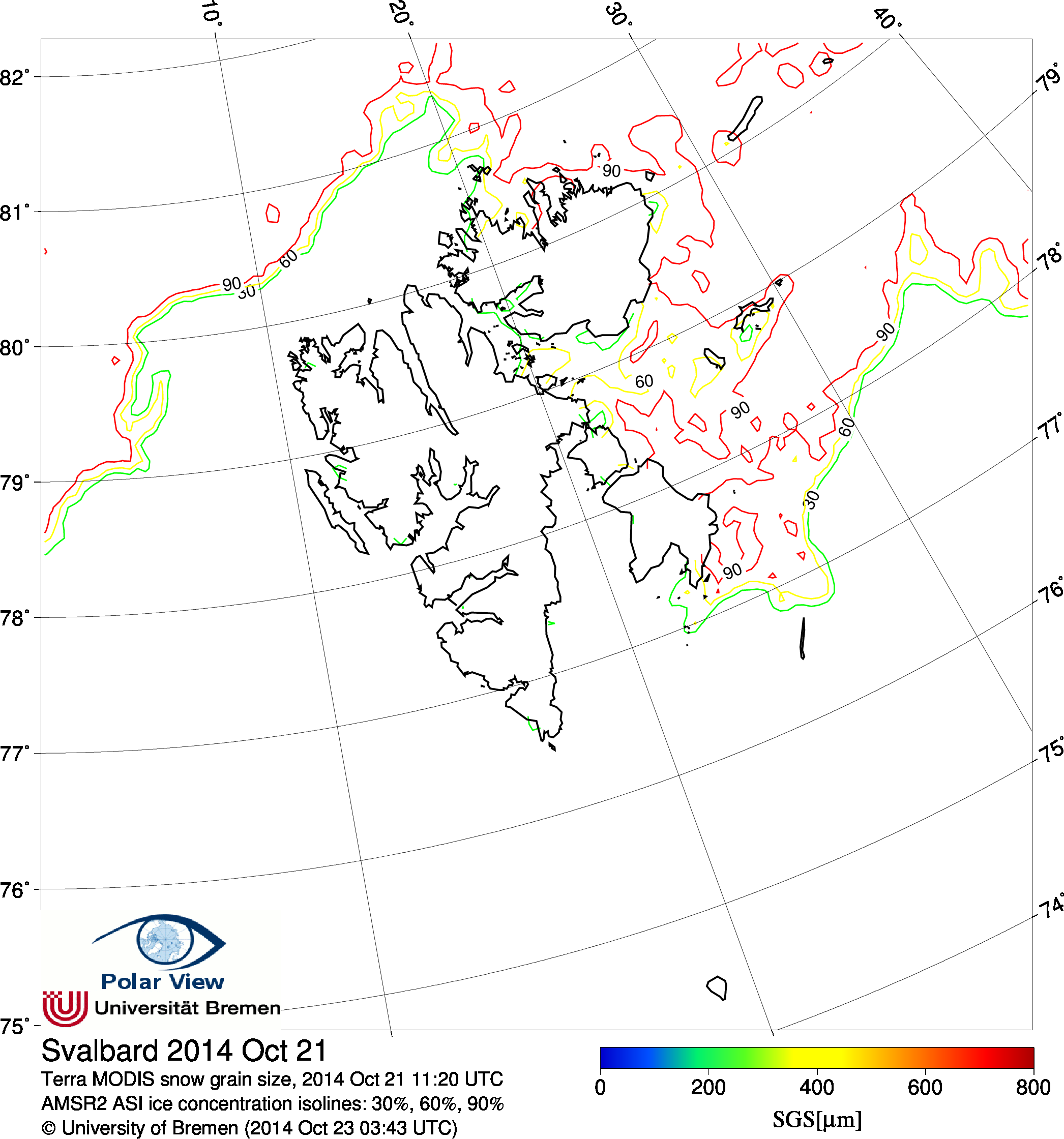
Attention: The Snow Grain Size and Soot Pollution products are experimental and not yet validated.
MODIS RGB composites
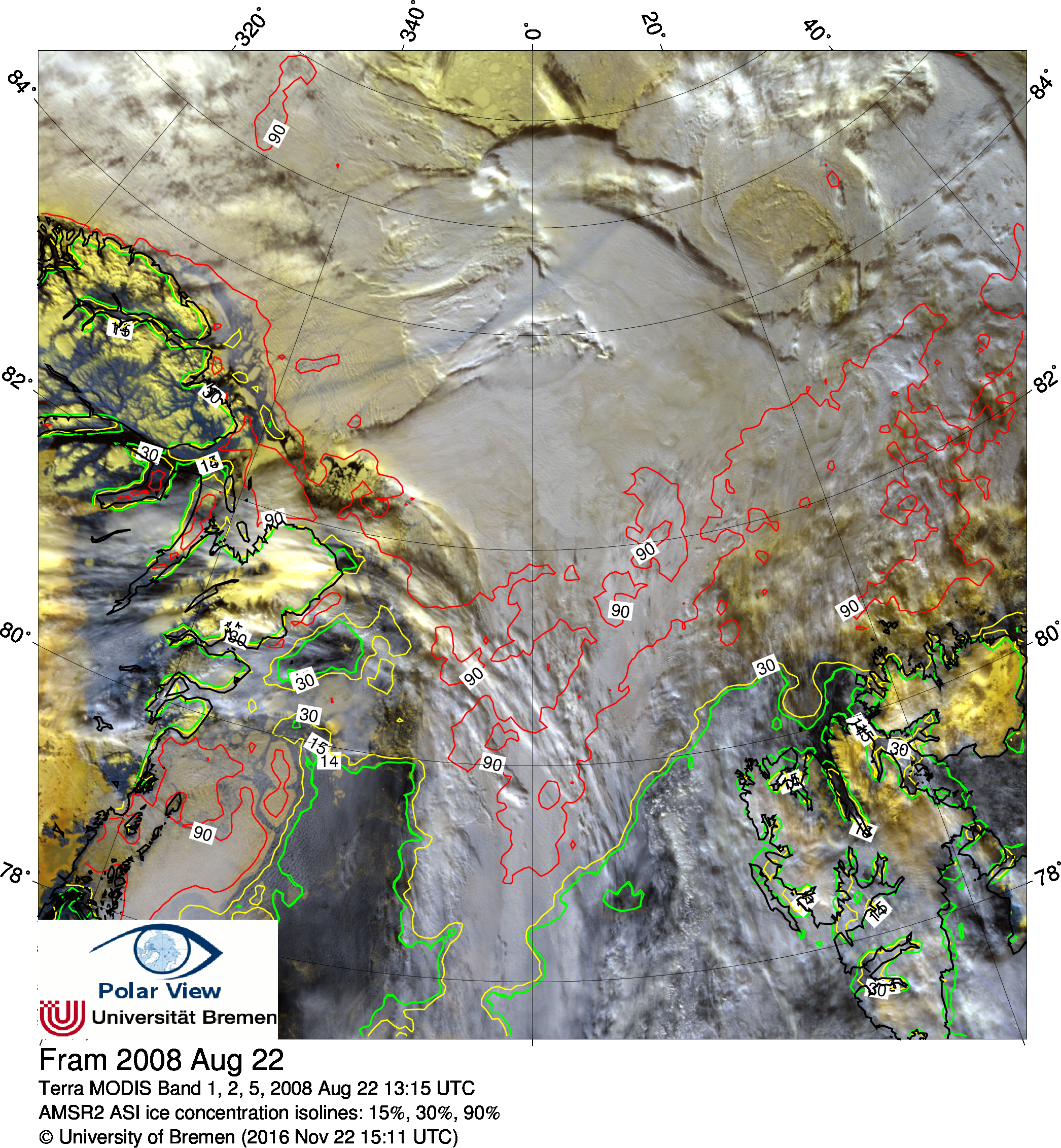
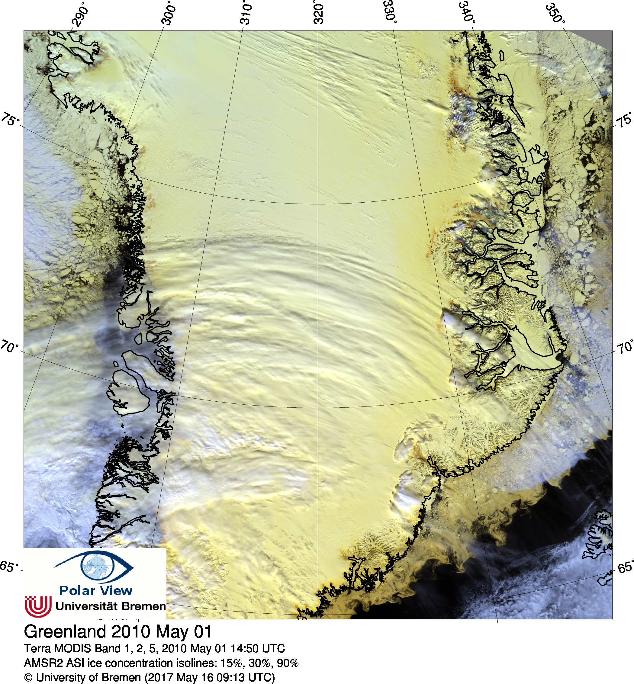
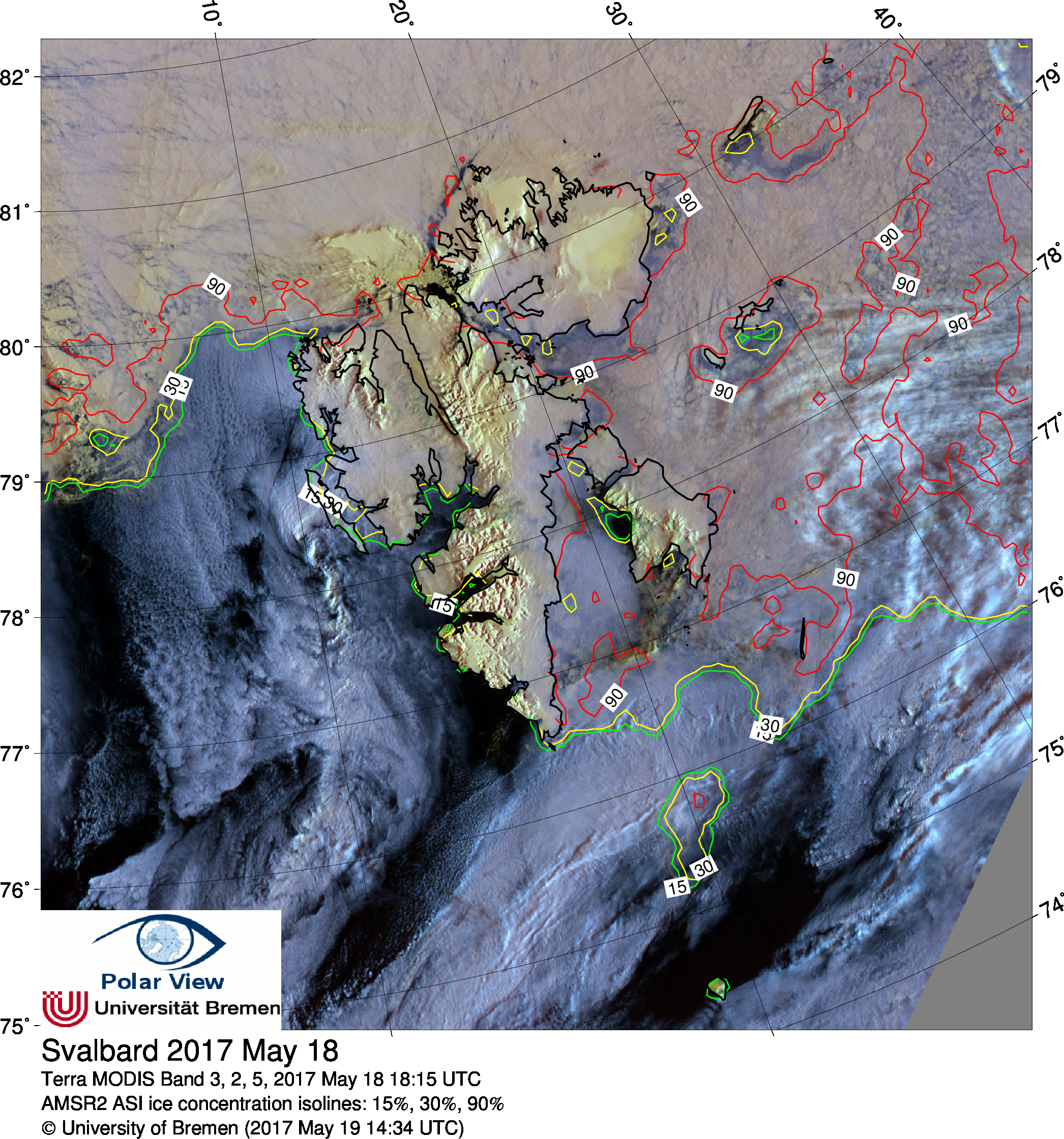
False color MODIS images with R = channel 3, G = channel 2, B = channel 5
Yellow indicates ice and snow, white and bluish indicate clouds
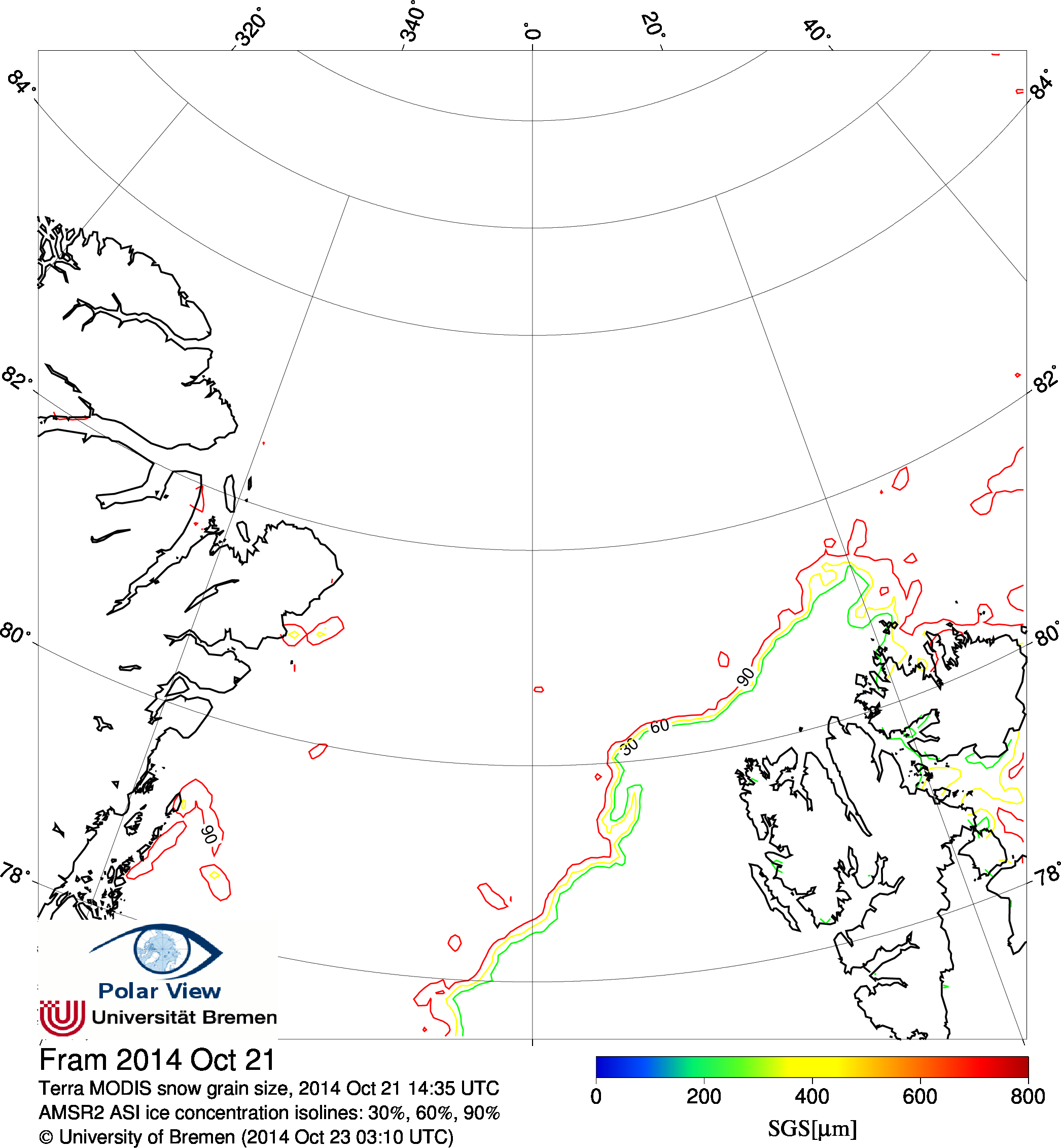
MODIS snow grain size
Snow grain size derived from MODIS data (based on channels 2, 3 and 5)
The algorithm used is described in Zege et al.(1998): The retrieval of the effective radius of snow grains and control of snow pollution with GLI data,
in Proceedings of Conference on Light Scattering by Nonspherical Particles: Theory, Measurements, and Applications,
and has been updated in the DAMOCLES project.
Data archive: MODIS