
| Back to main page |
|
|
|
|
|
|
|
|
|
|
|
|||
|
|
|
|
|
 |
 |
 |
 |
|
|
|
|
|
 |
 |
 |
 |
|
|
|||
 |
|||
|
|
|||
|
|
|
|
|
 |
 |
 |
 |
|
|
|
|
|
 |
 |
 |
 |
|
|
|||
 |
|||
|
|
|||
|
|
|
|
|
 |
 |
 |
 |
|
|
|
|
|
 |
 |
 |
 |
|
|
|||
 |
|||
|
Data archive: Arctic Antarctic Data files and grid coordinates files for every region in HDF and GEOTIFF format are also accessible via the data archive. |
|||
|
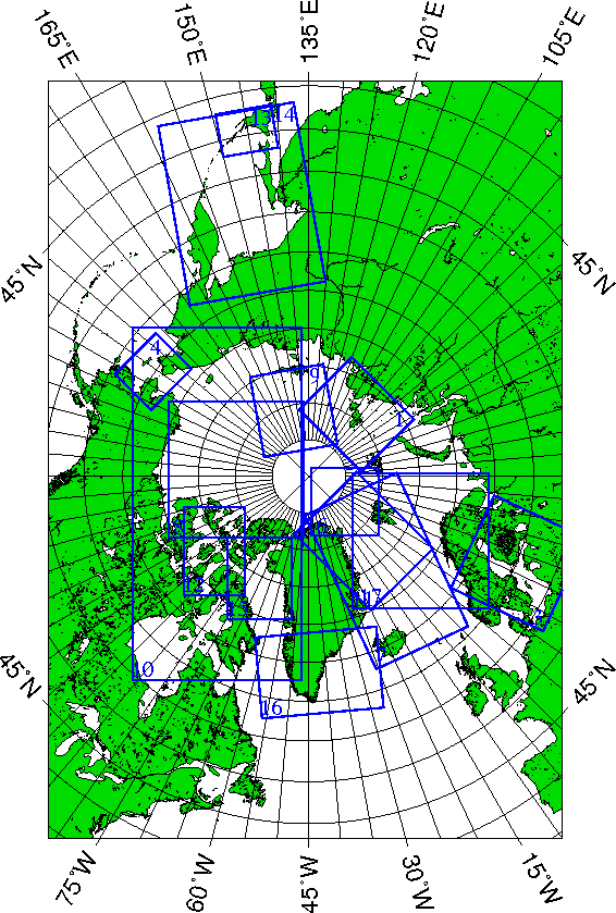
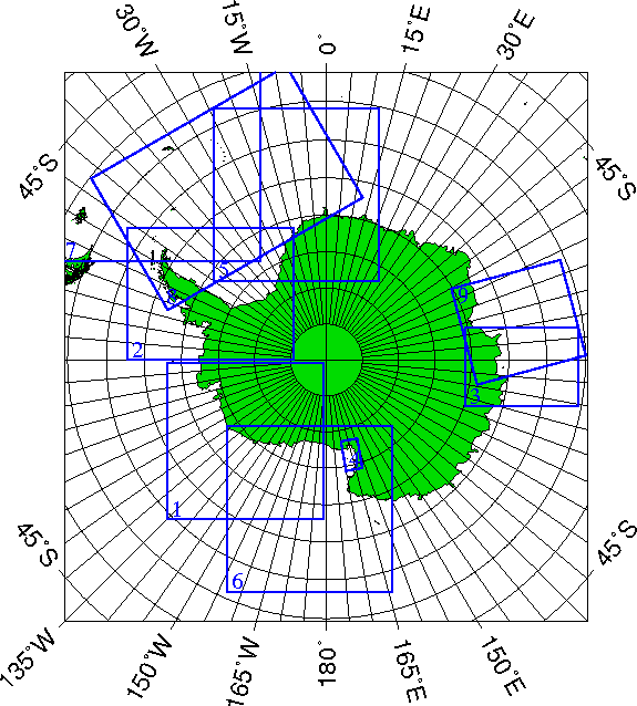
Please contact us if you need any other special region. Information regarding the location and projection used for the regions can be found here. |
|||
|
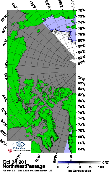
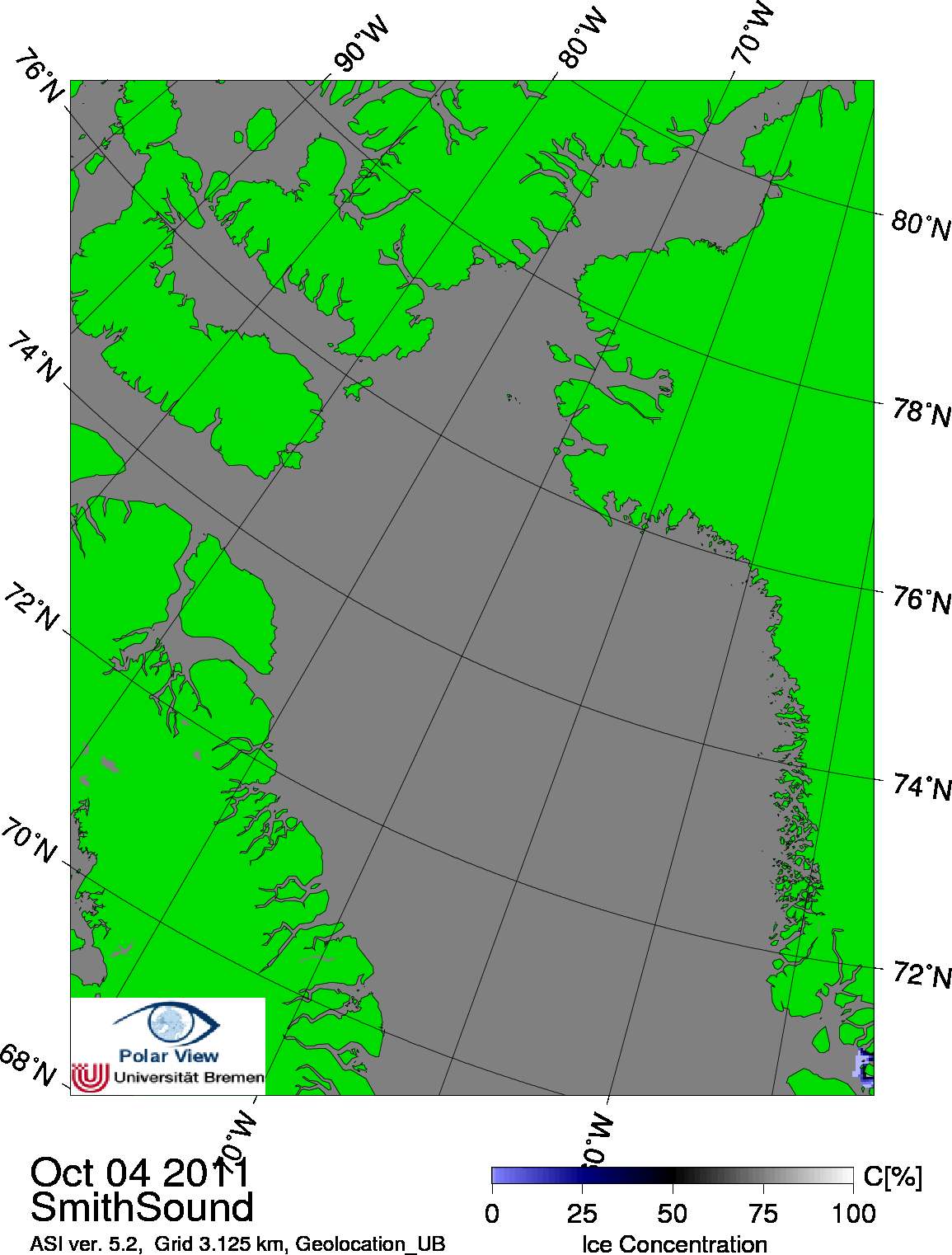
All level 1A data are received from the National Space Development Agency of Japan. Distributed by: Boulder, CO, USA: National Snow and Ice Data Center. FTP download. |
|||
|
|
|||
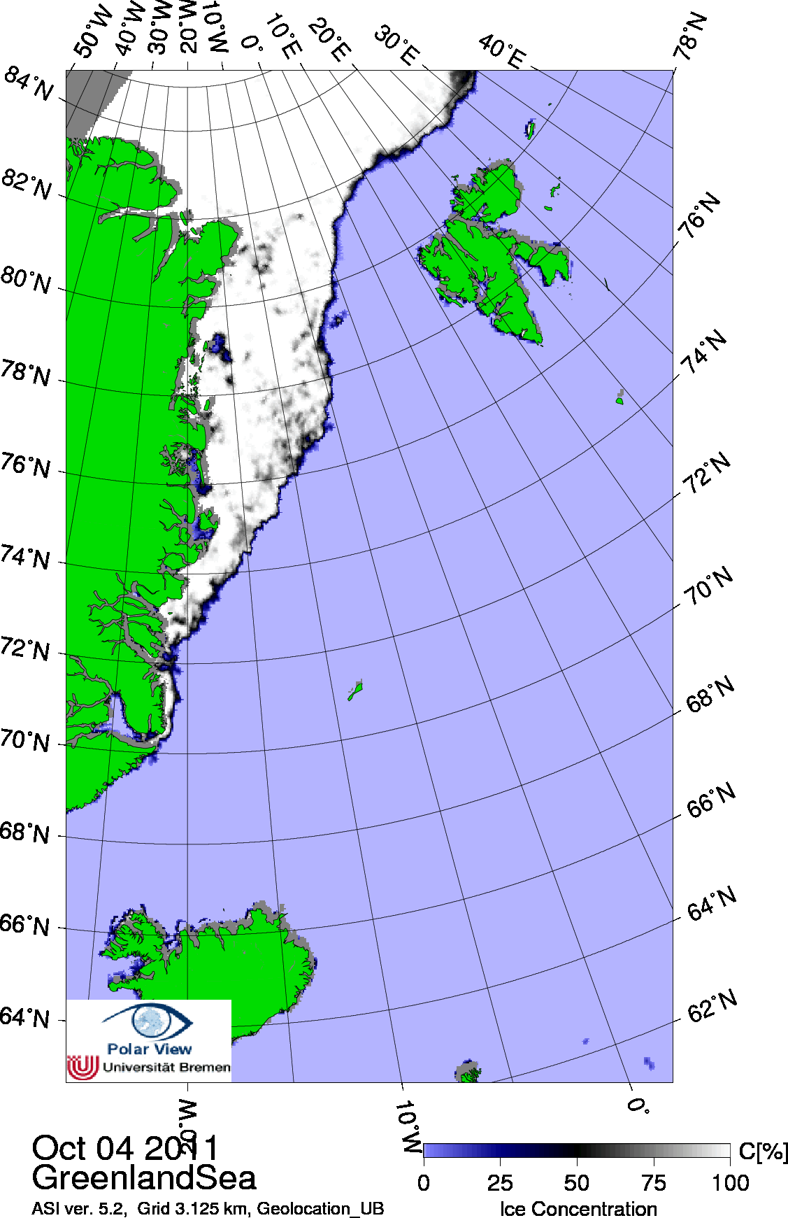
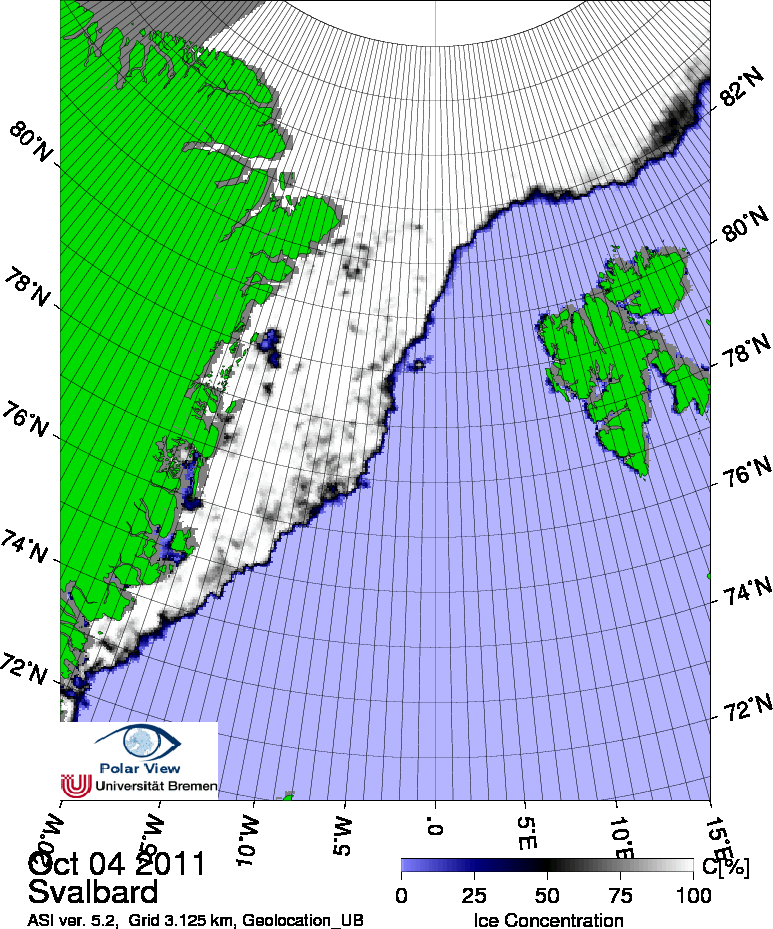
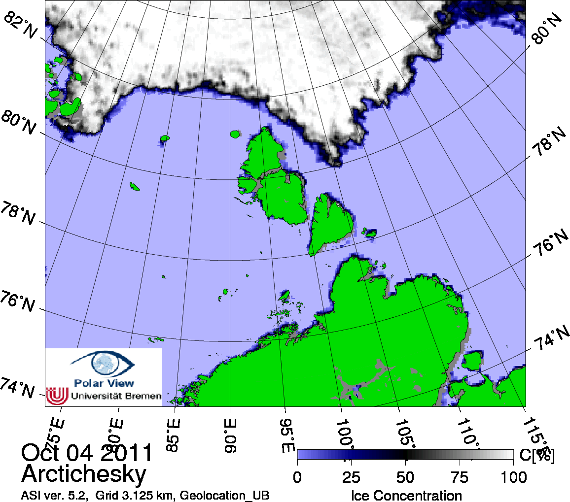
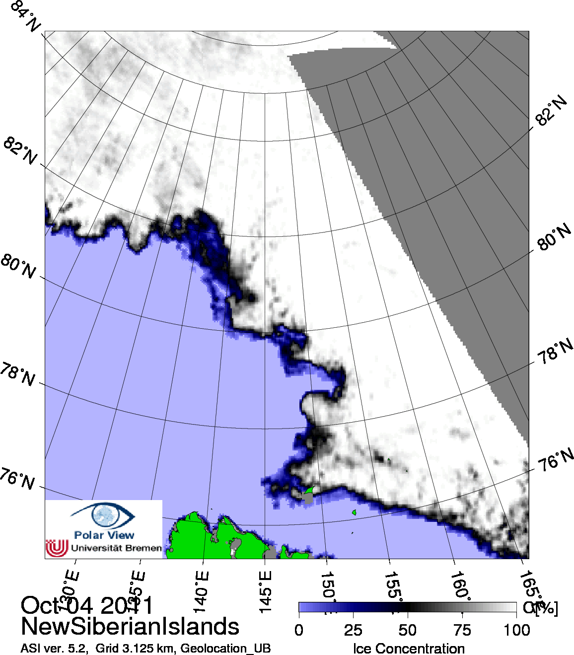
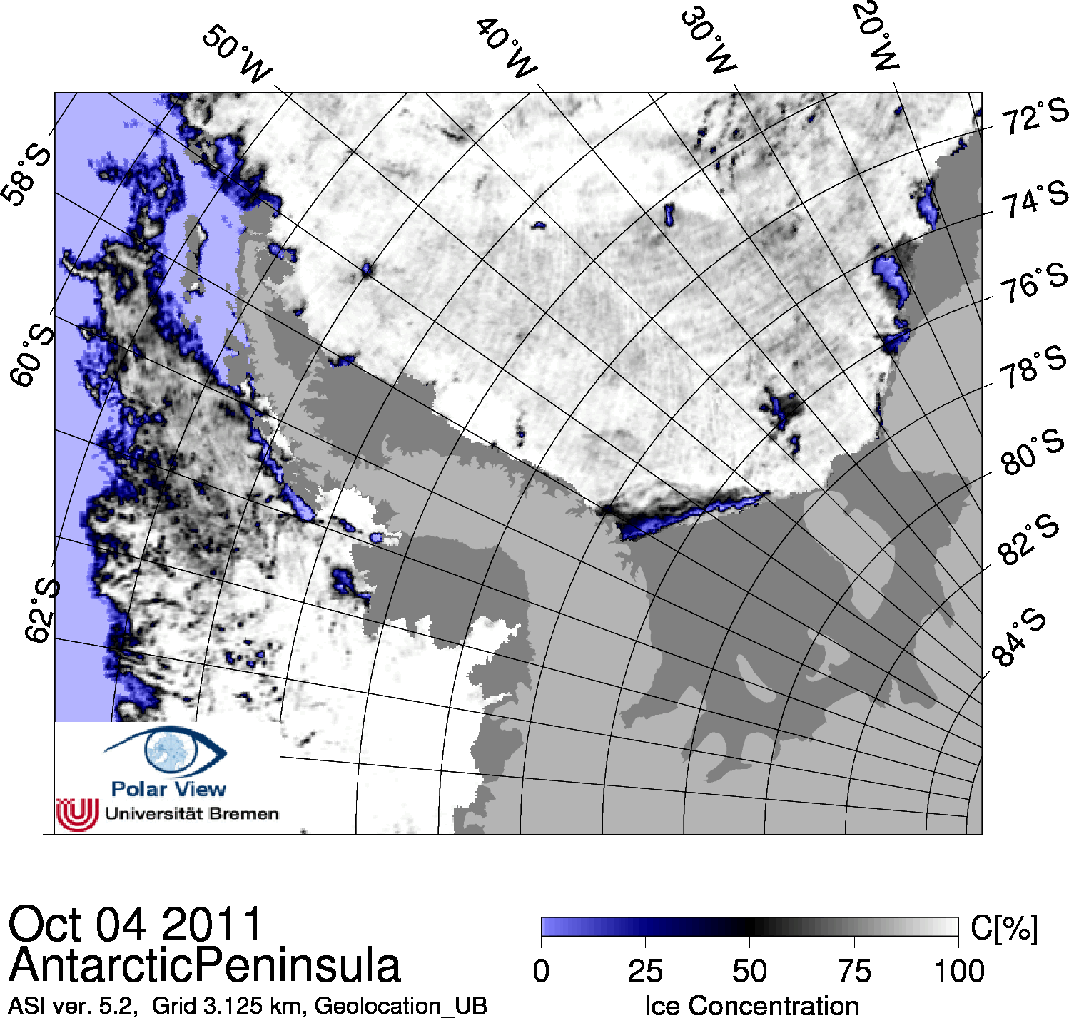
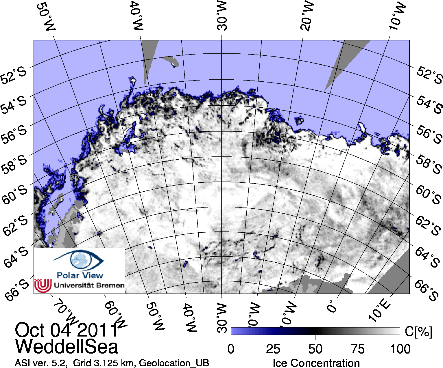
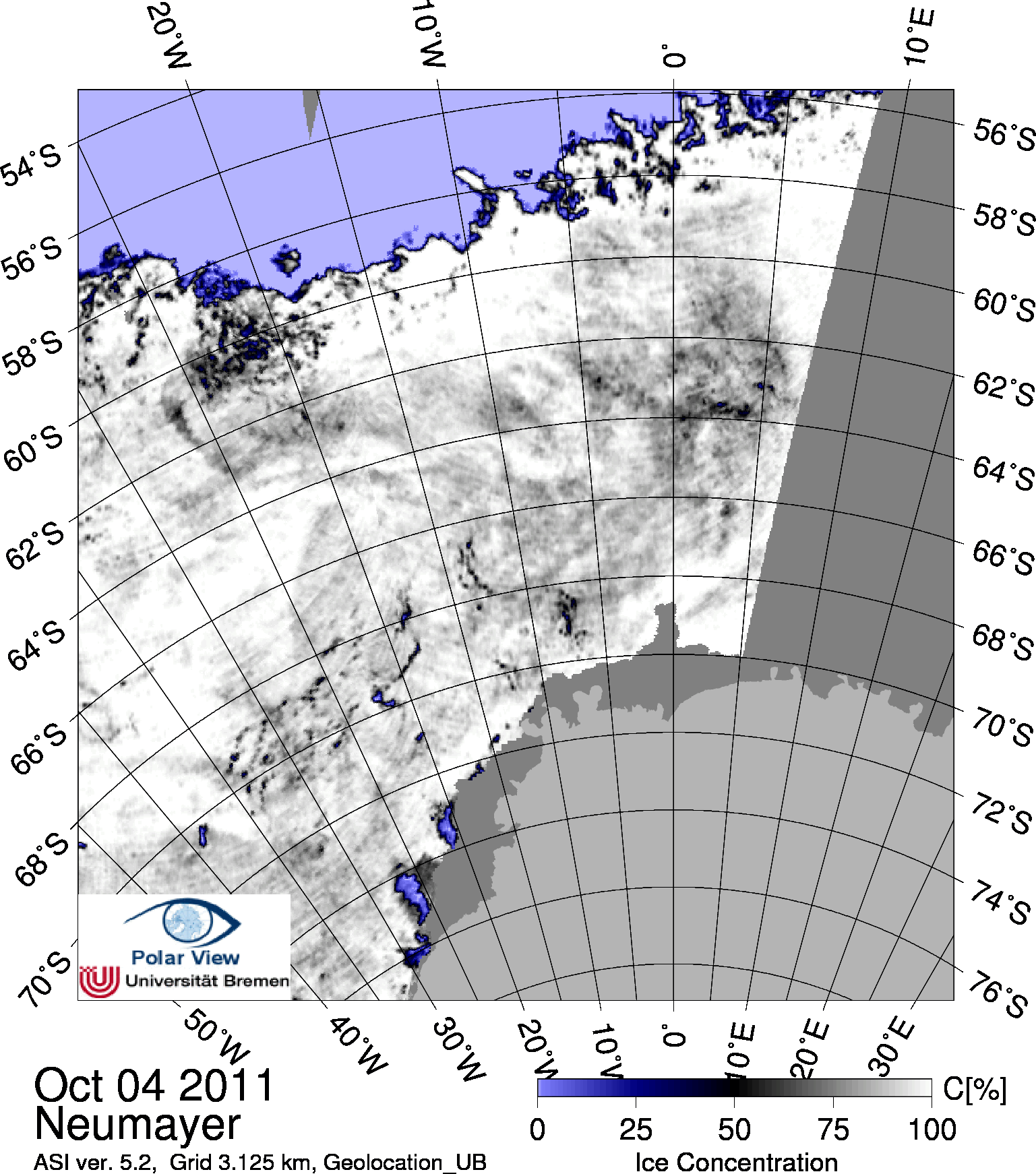
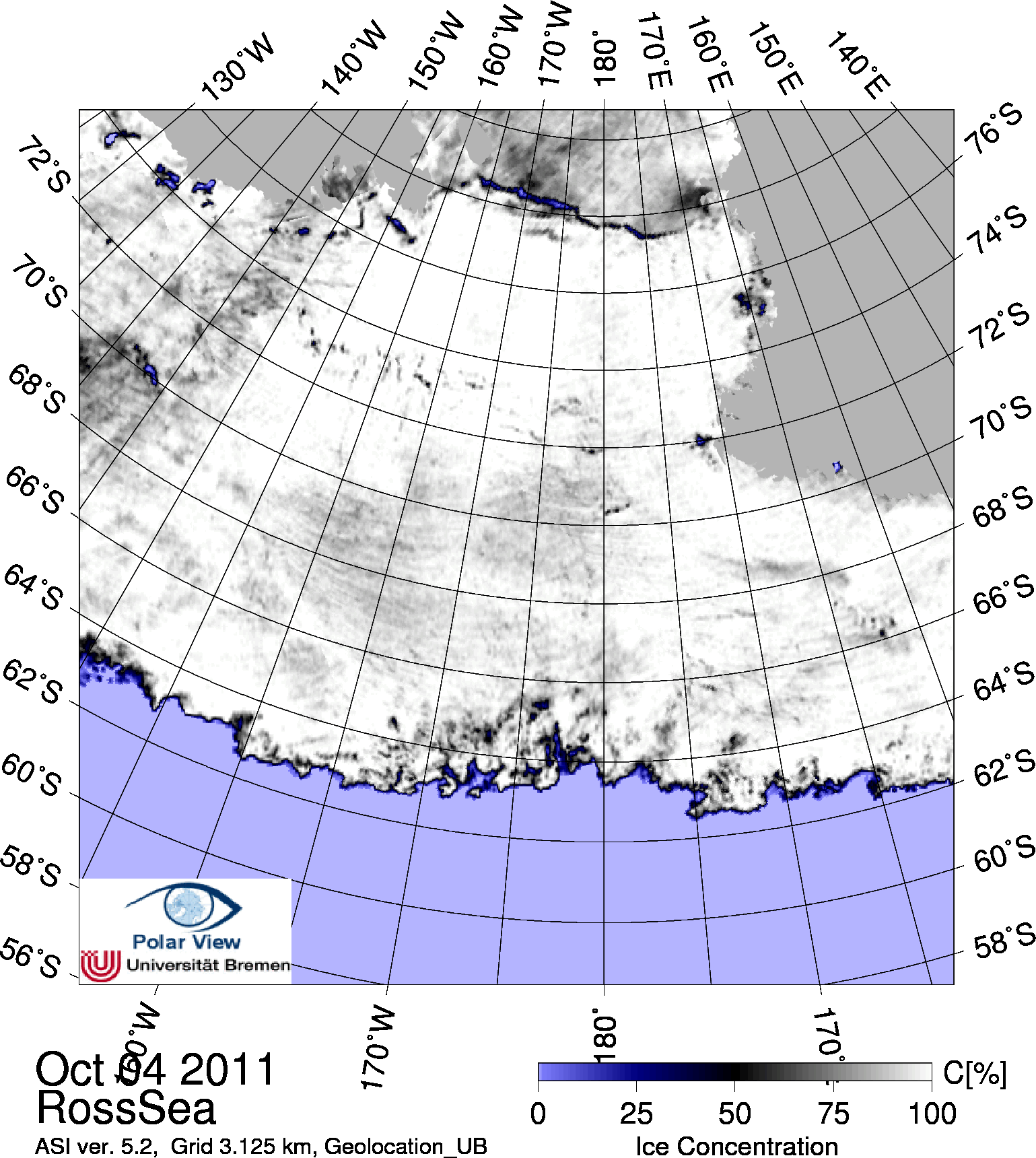
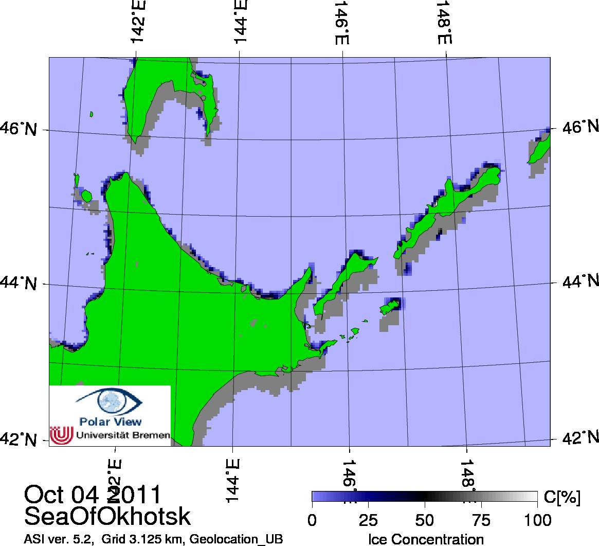
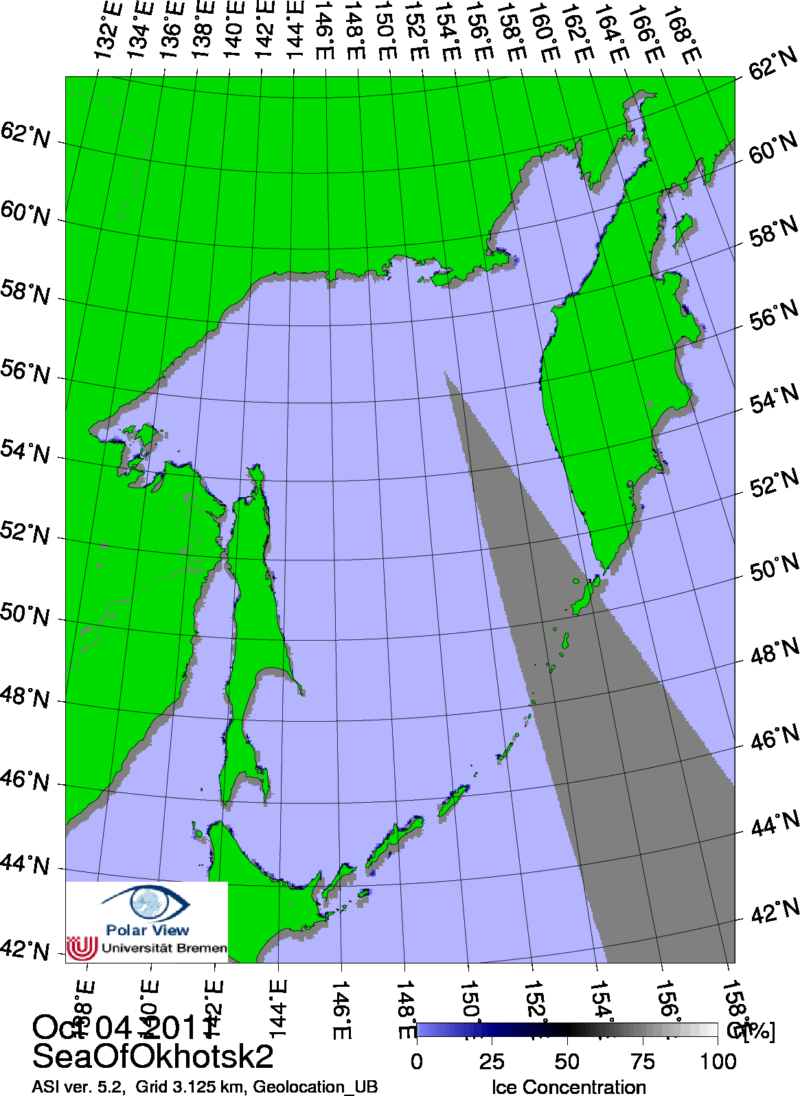
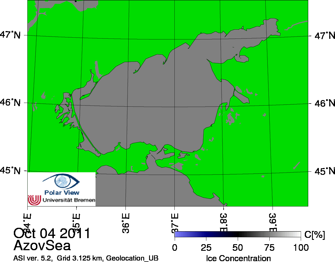
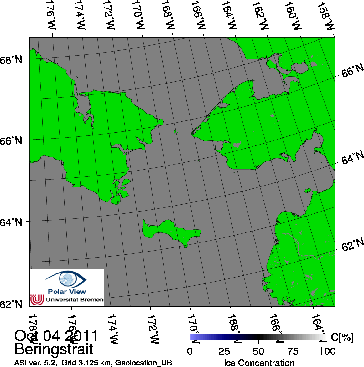
| No warranty, expressed or implied, is made regarding the accuracy or utility of the data! False ice concentrations can occur due to bad weather systems. | |||
|
|
|||
| Back to main page |
|