|
|
|
|
|
|
|
|
|
|
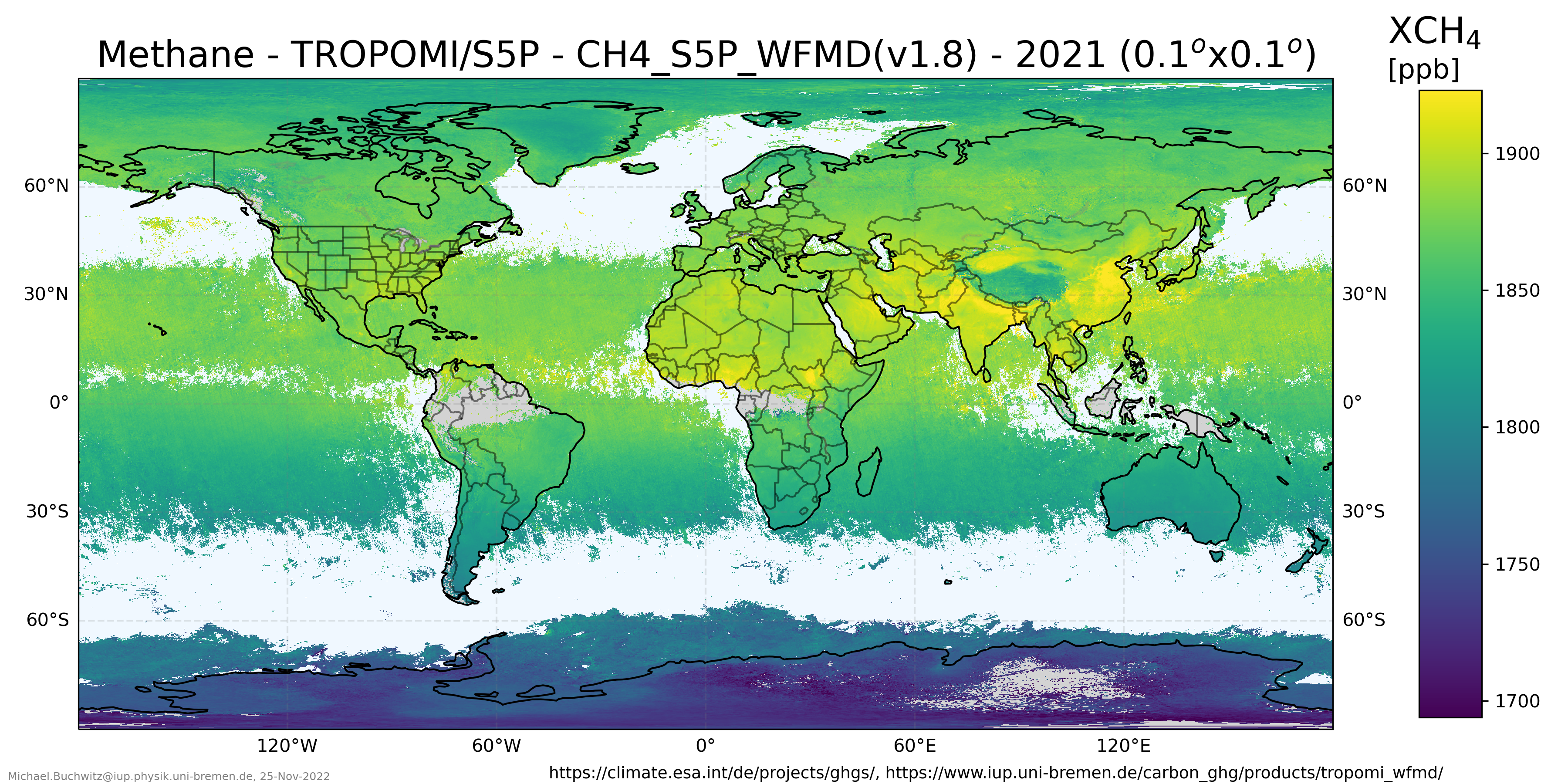
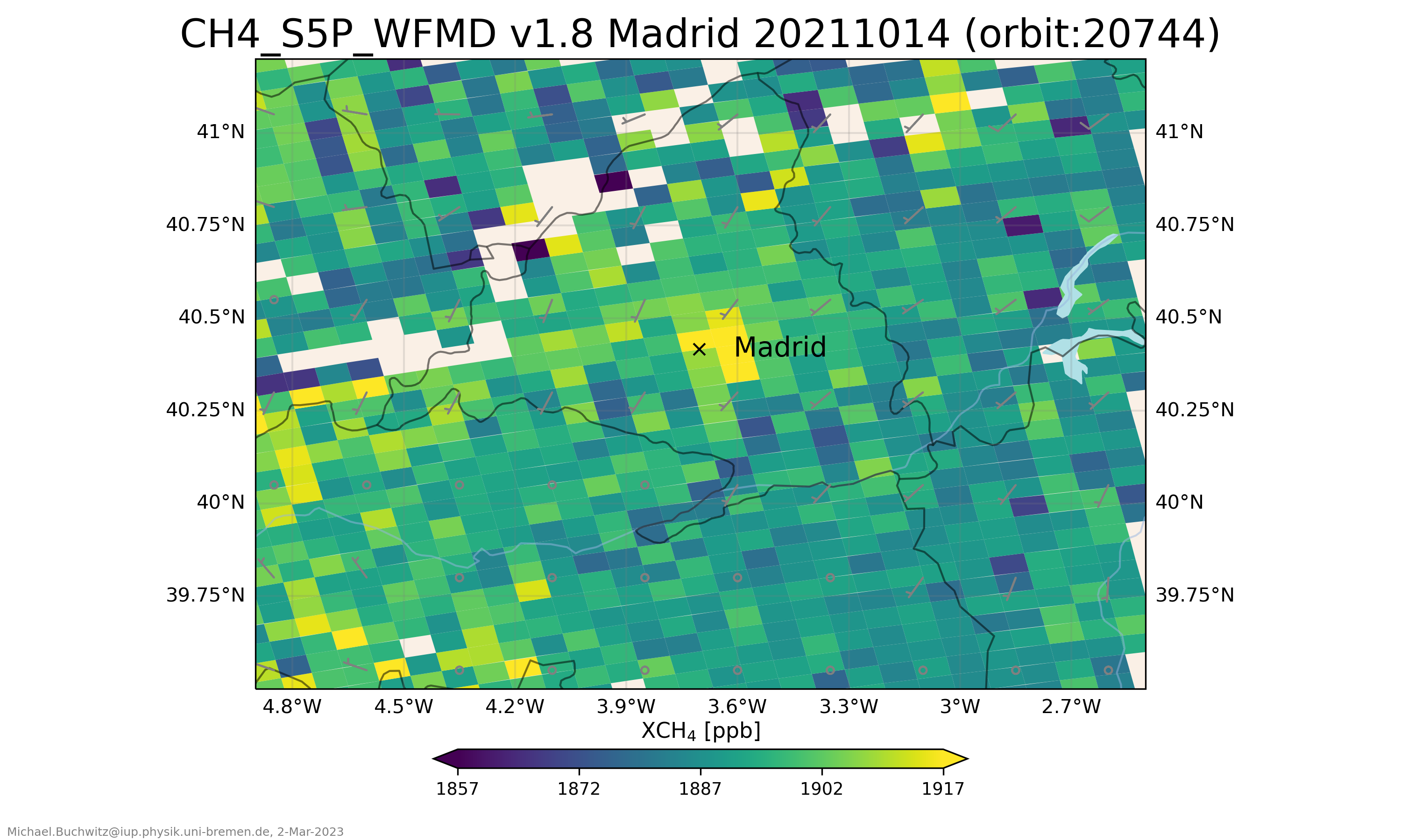
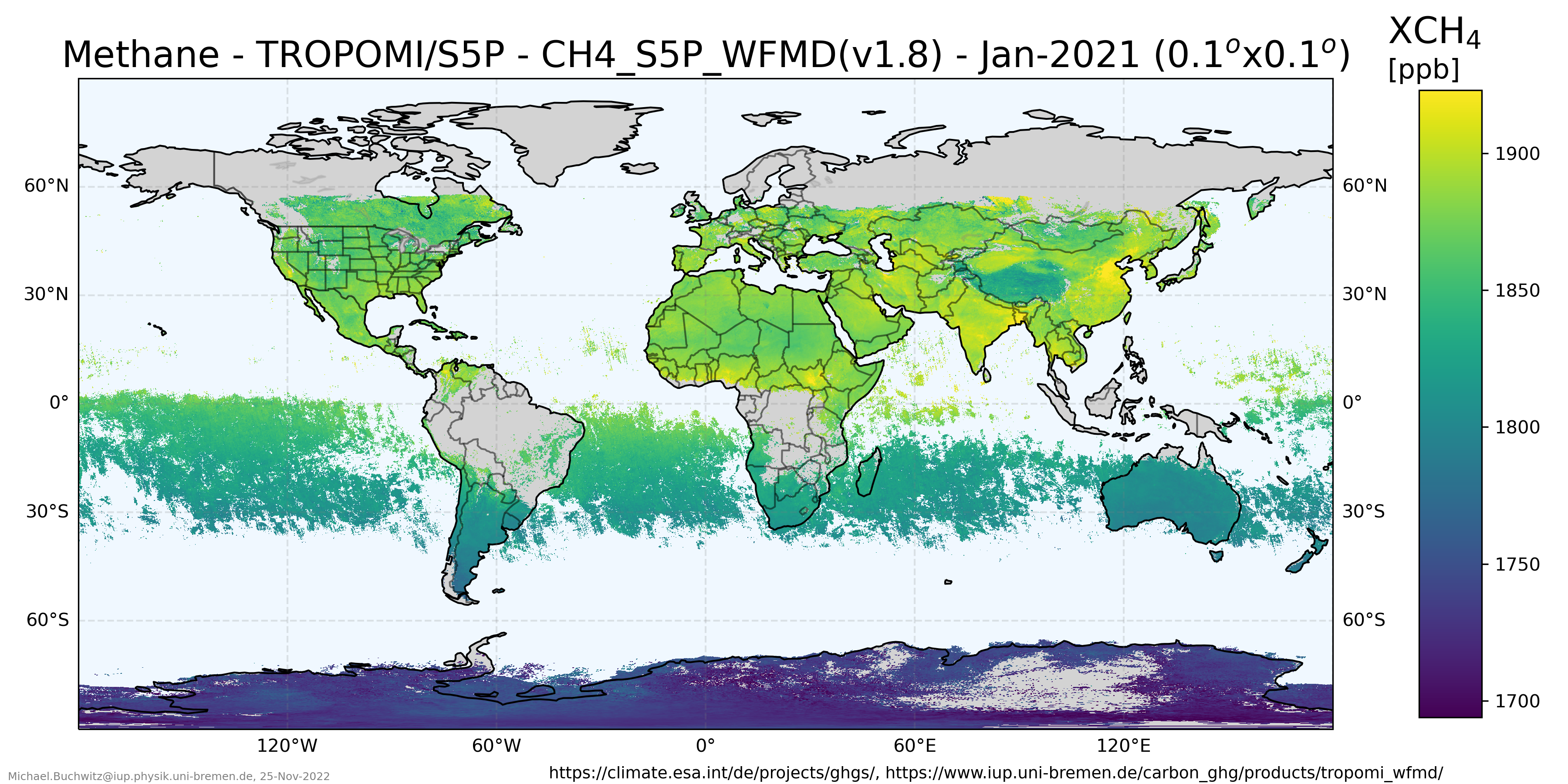
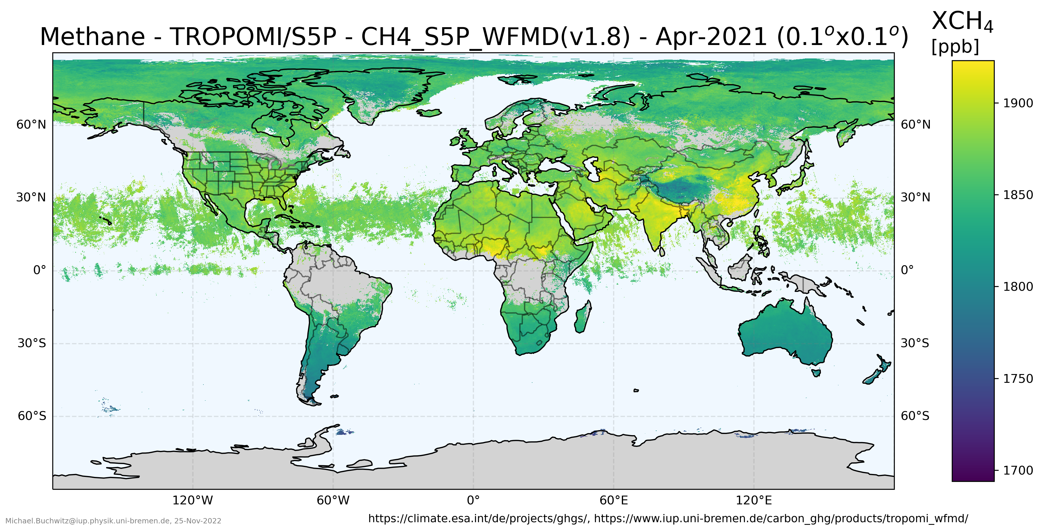
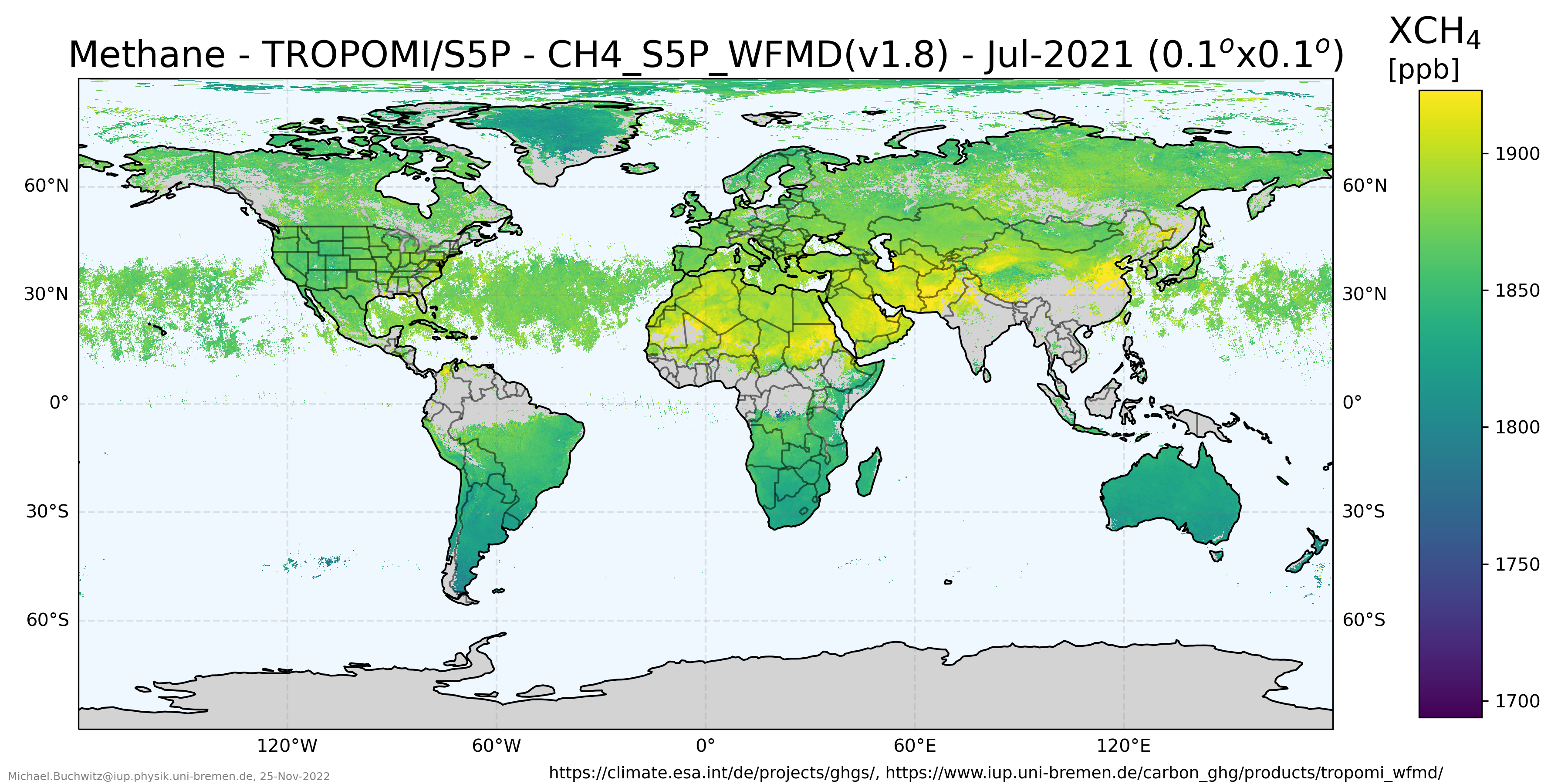
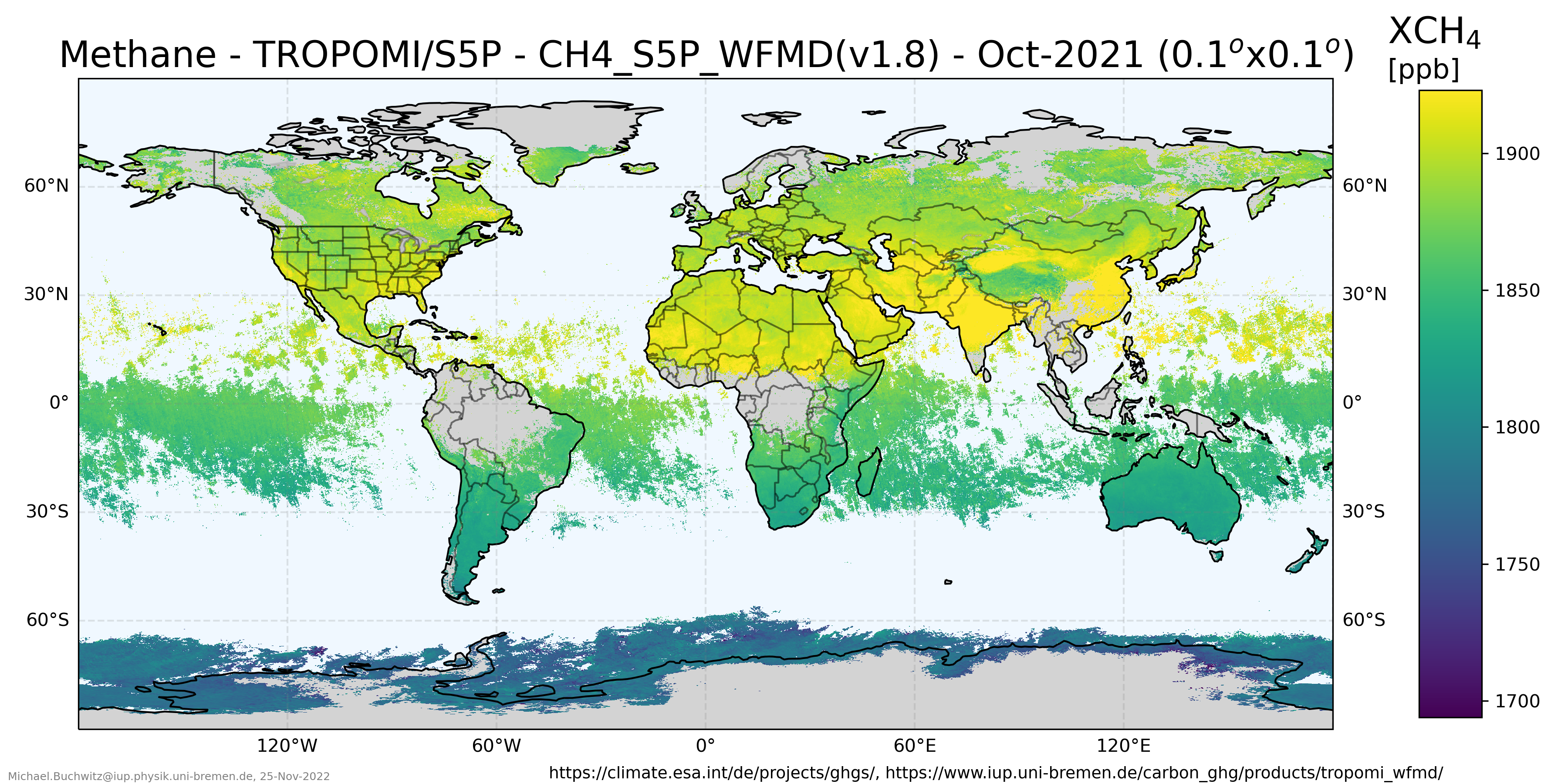
Maps of satellite-derived column-average CH4, i.e., XCH4:
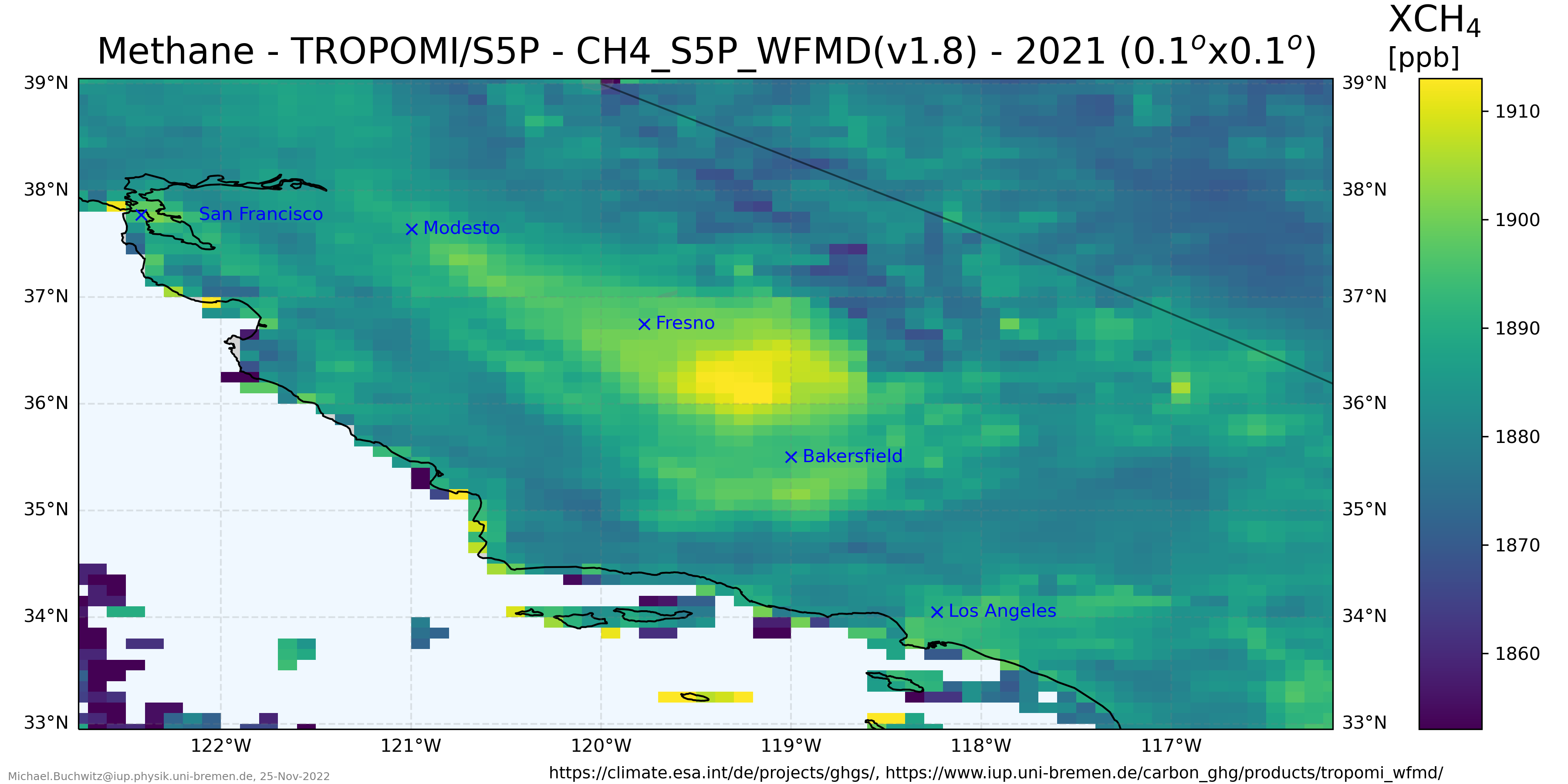
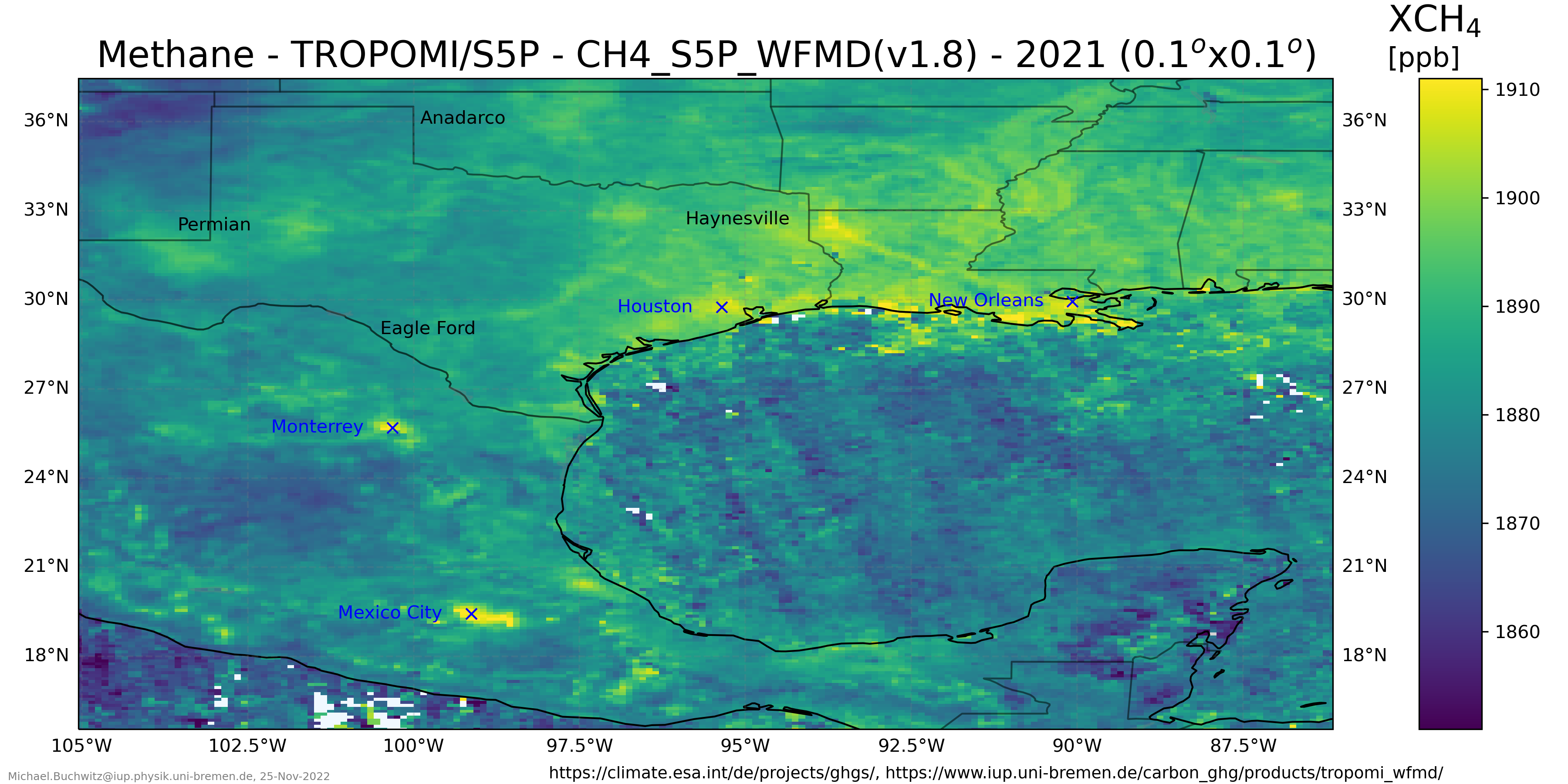
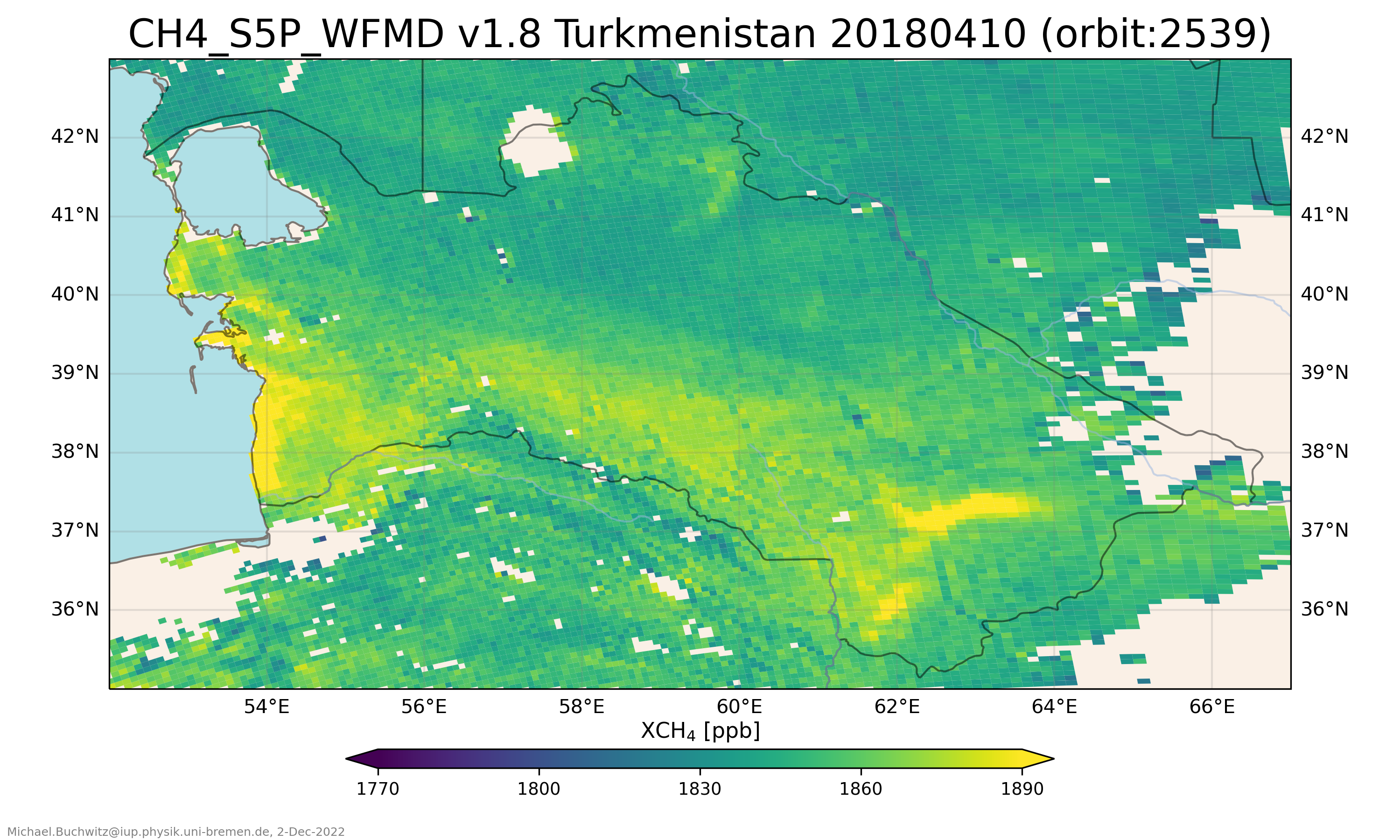
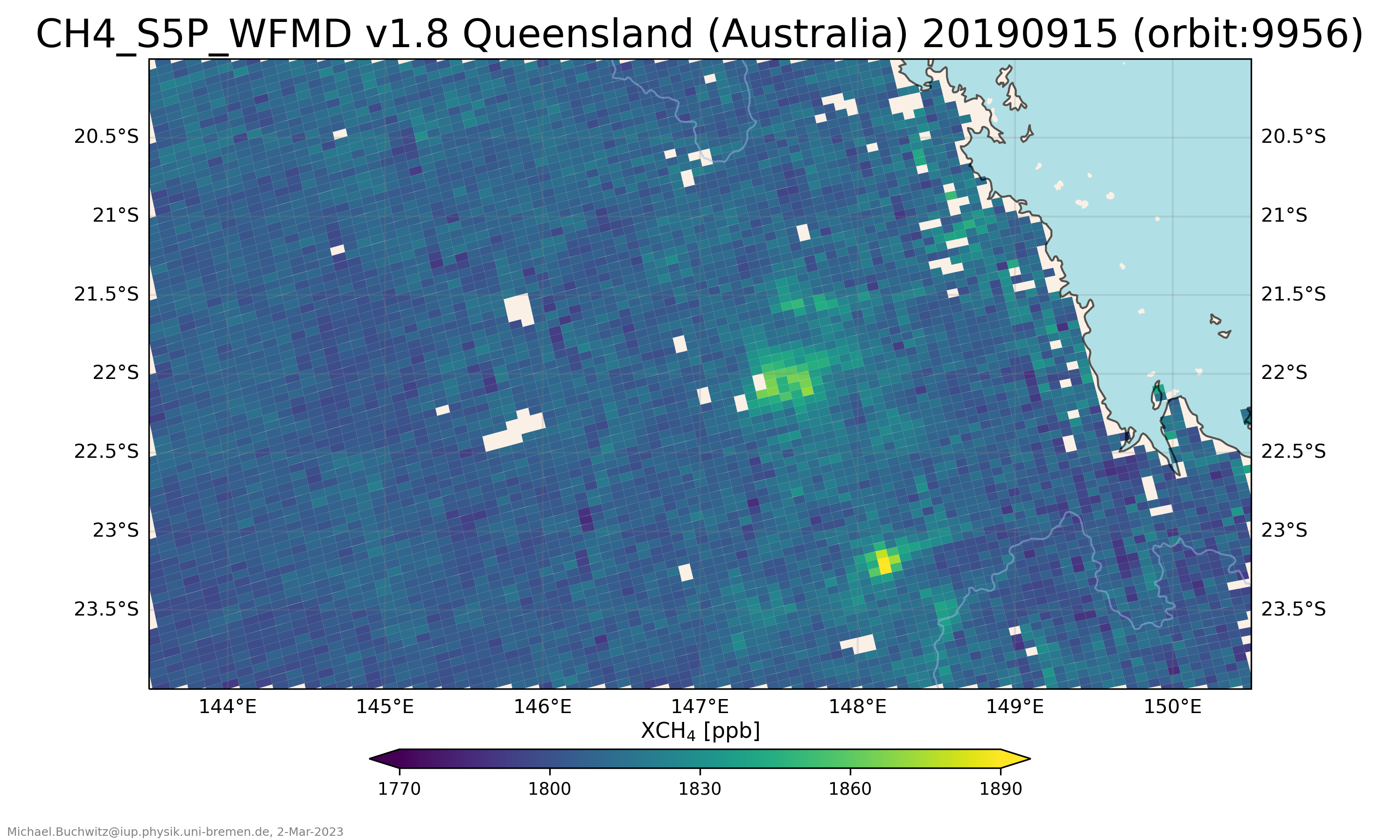
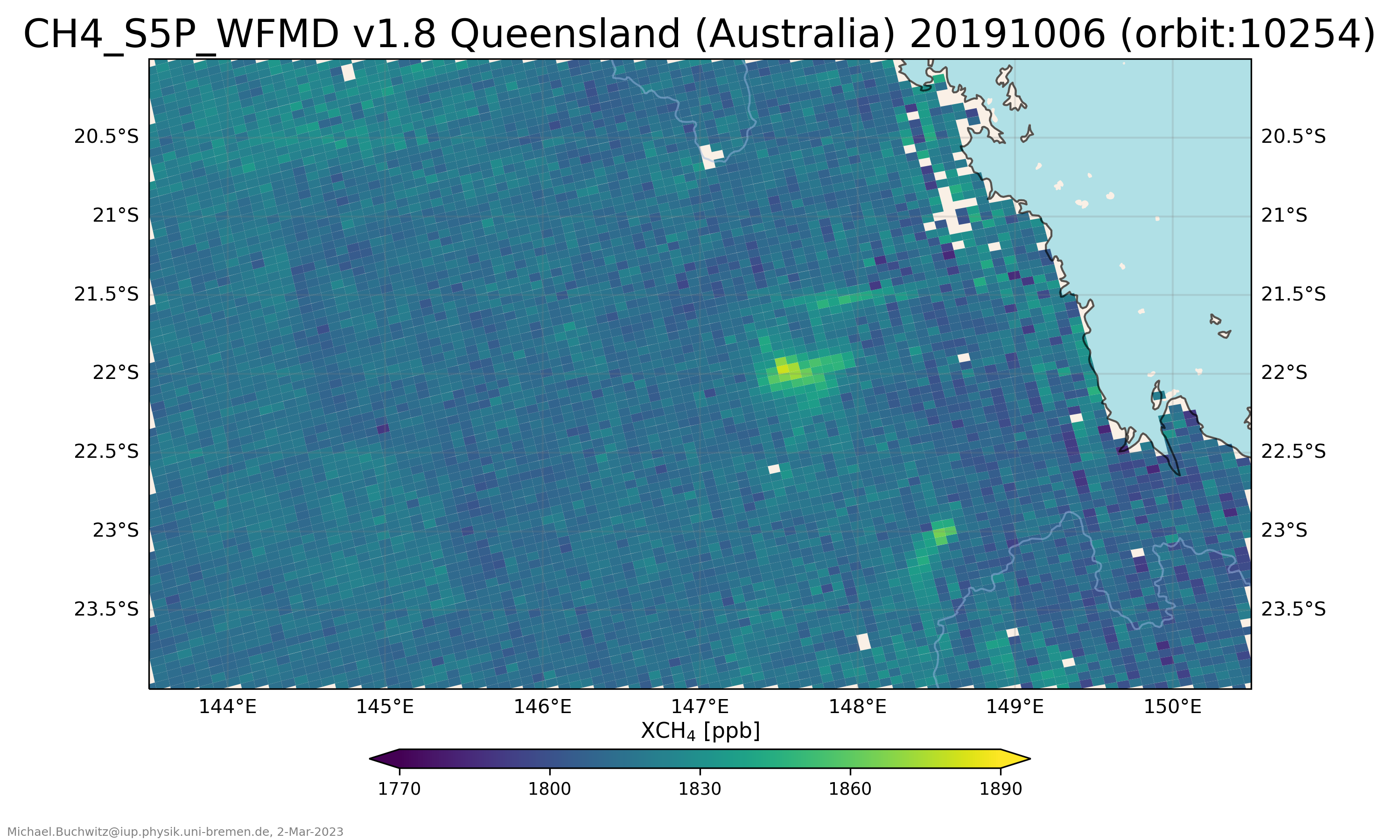
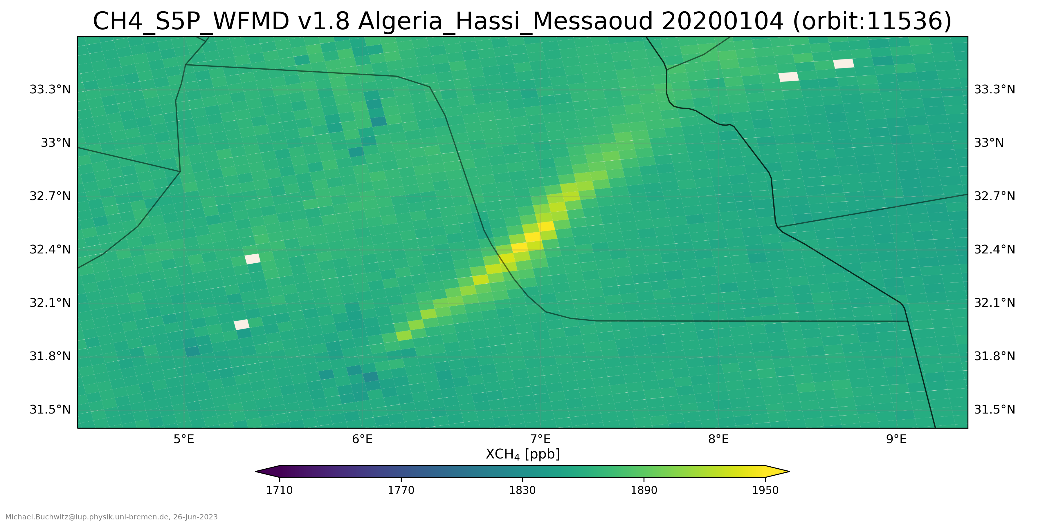
Overview selected regions with locally elevated methane:
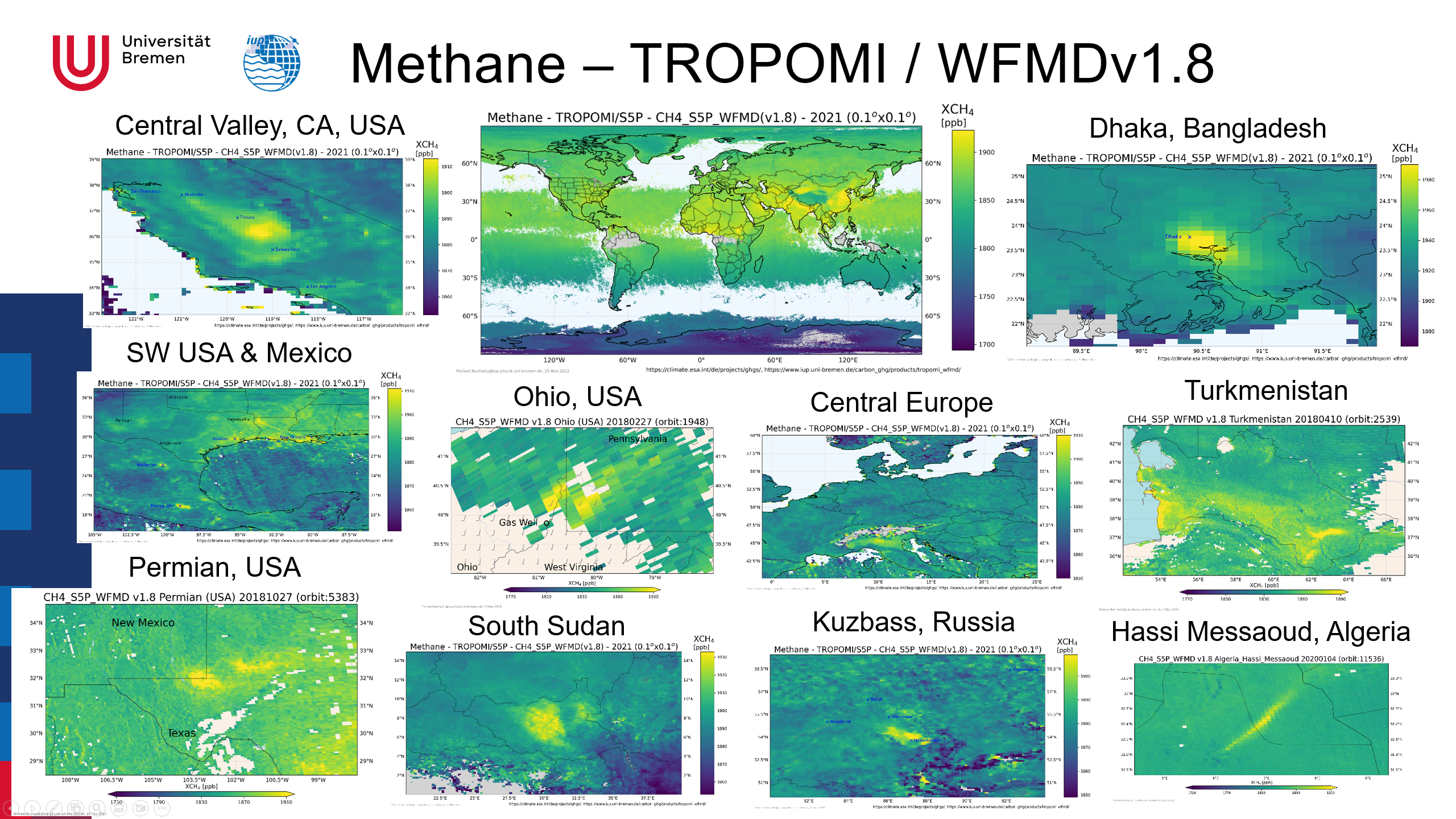
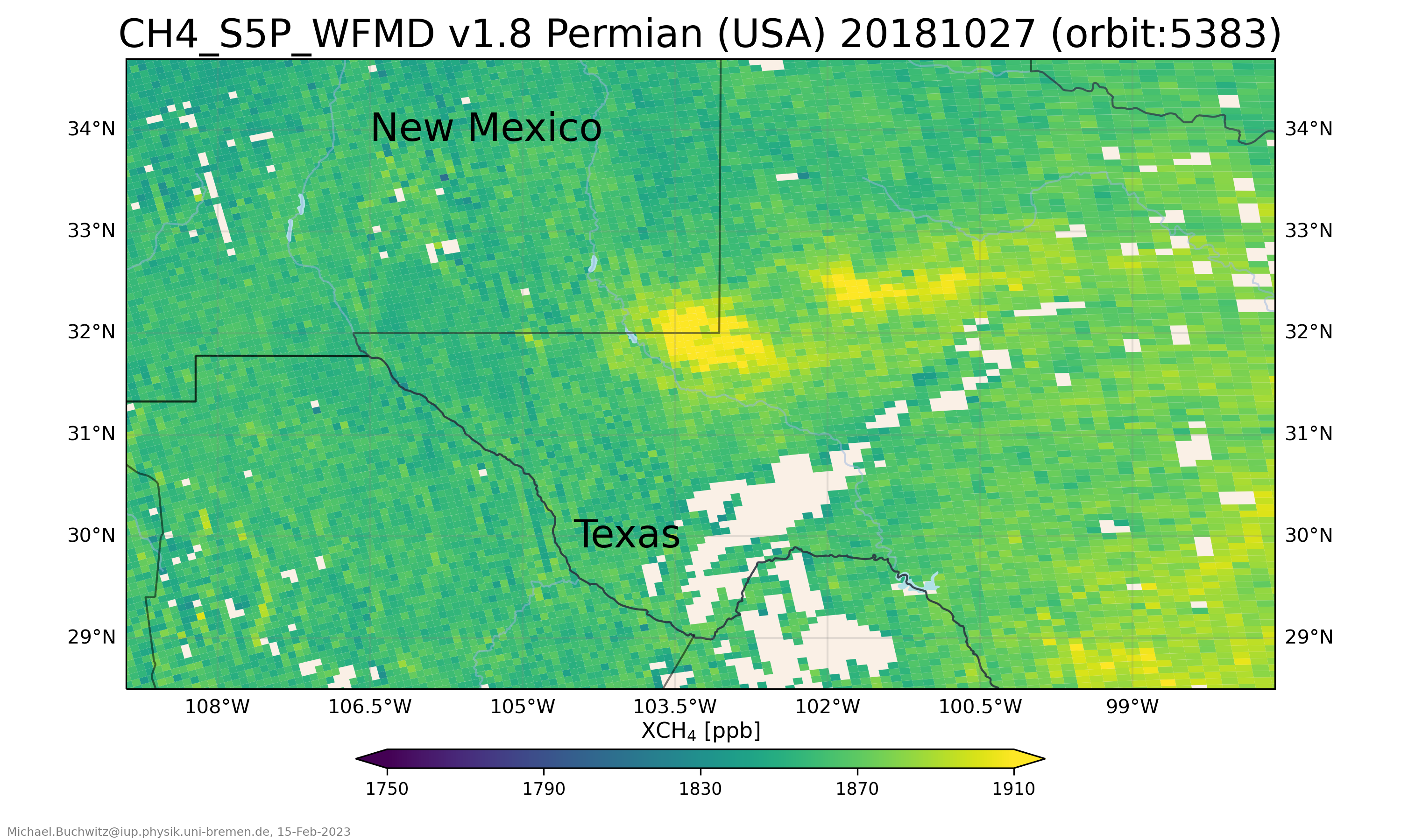
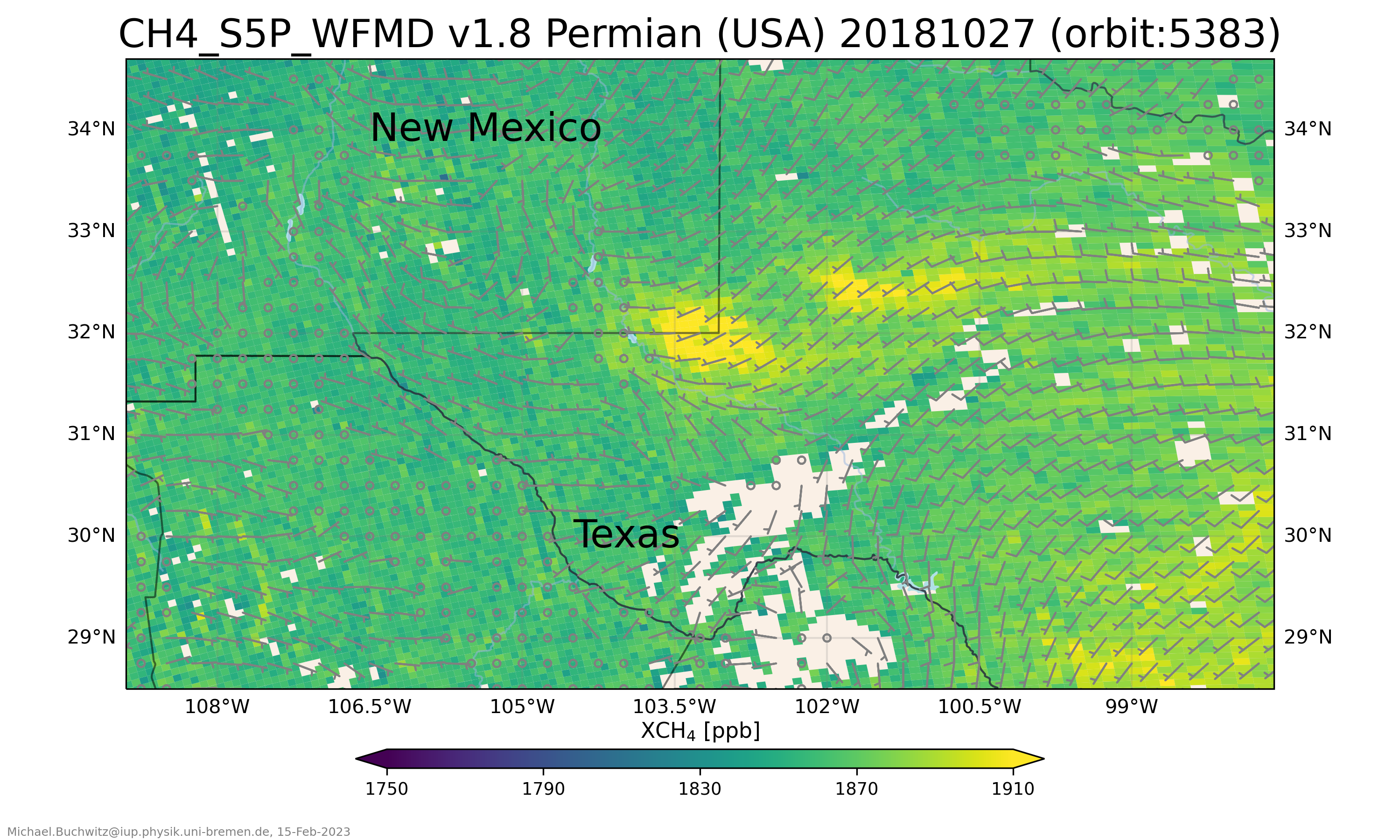
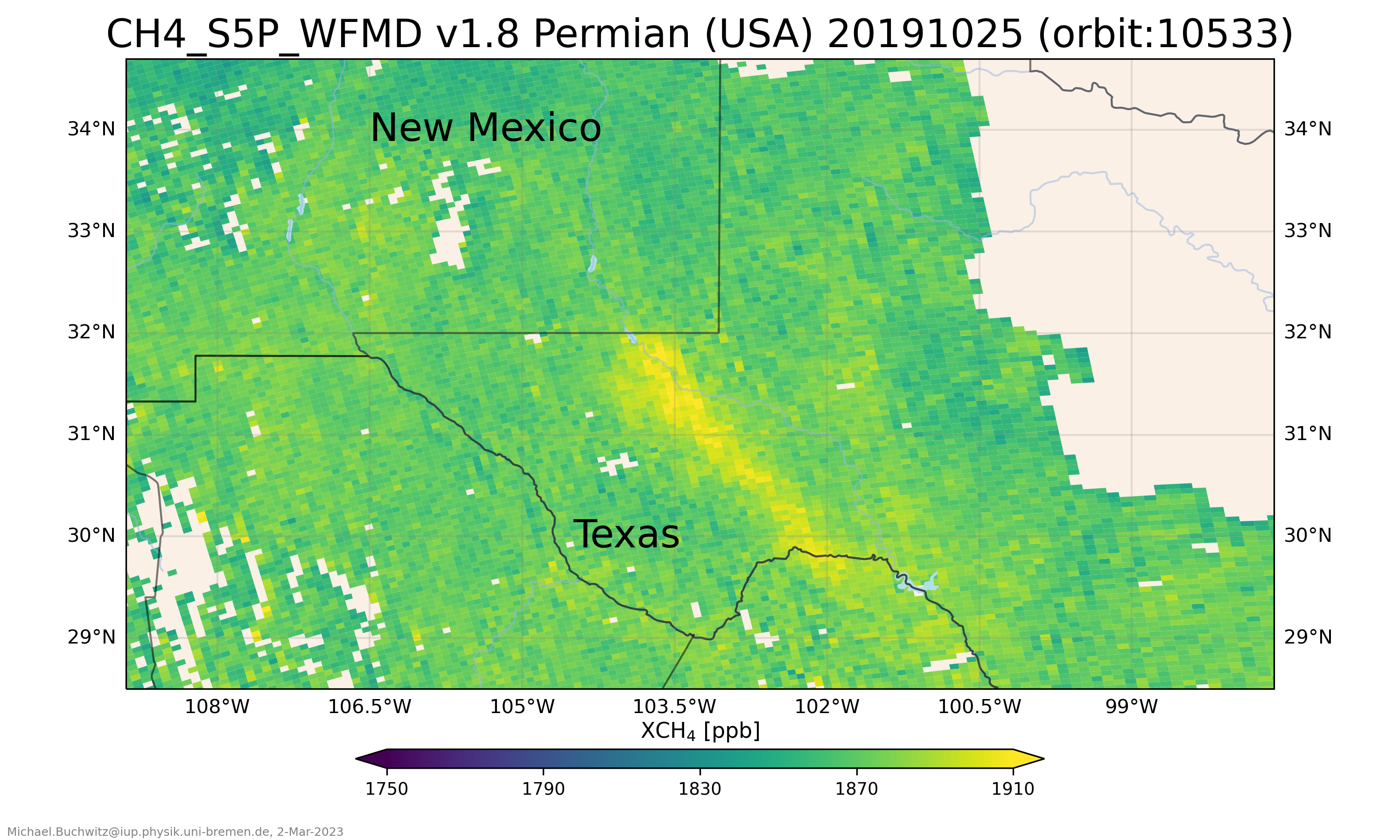
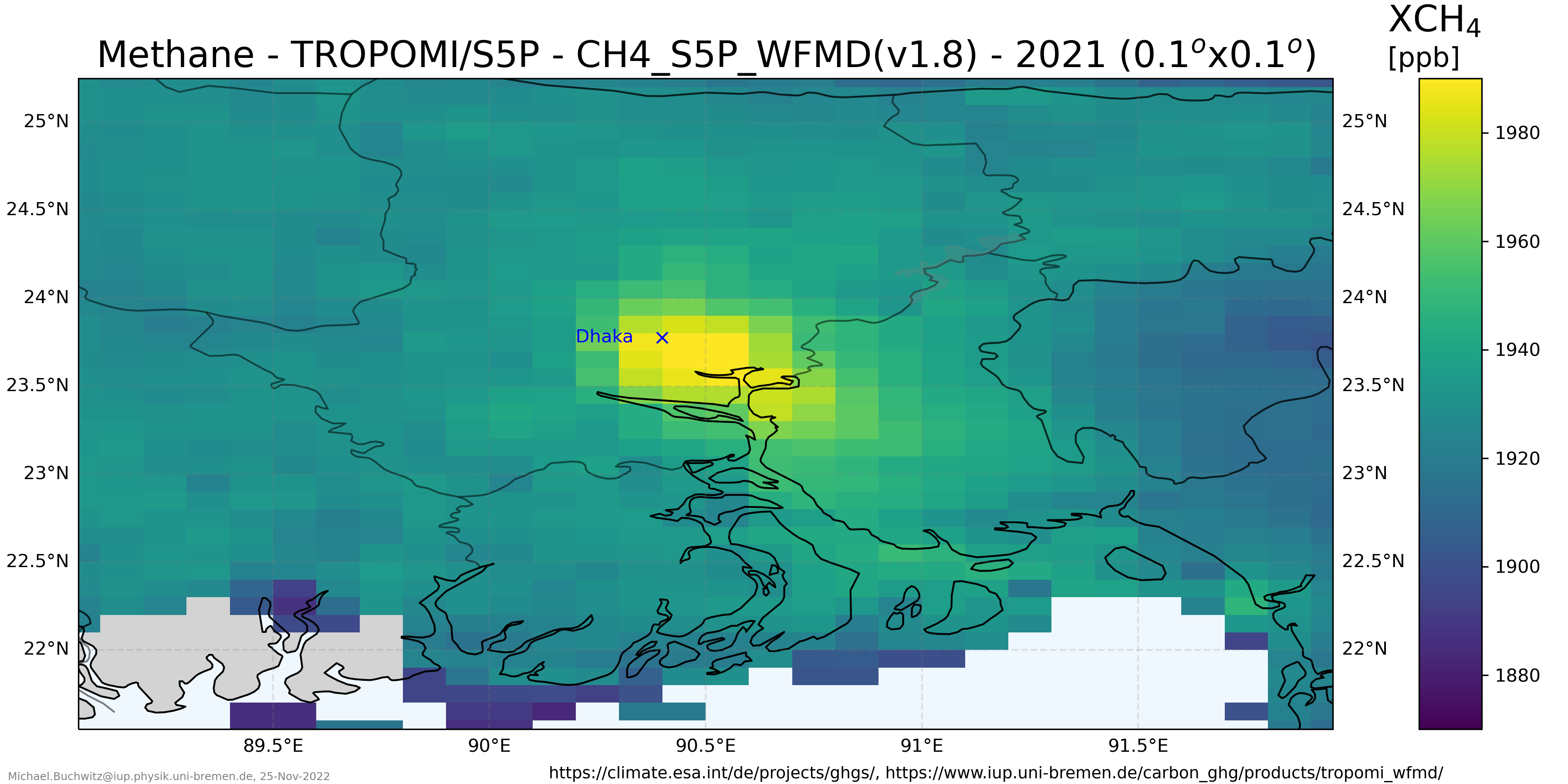
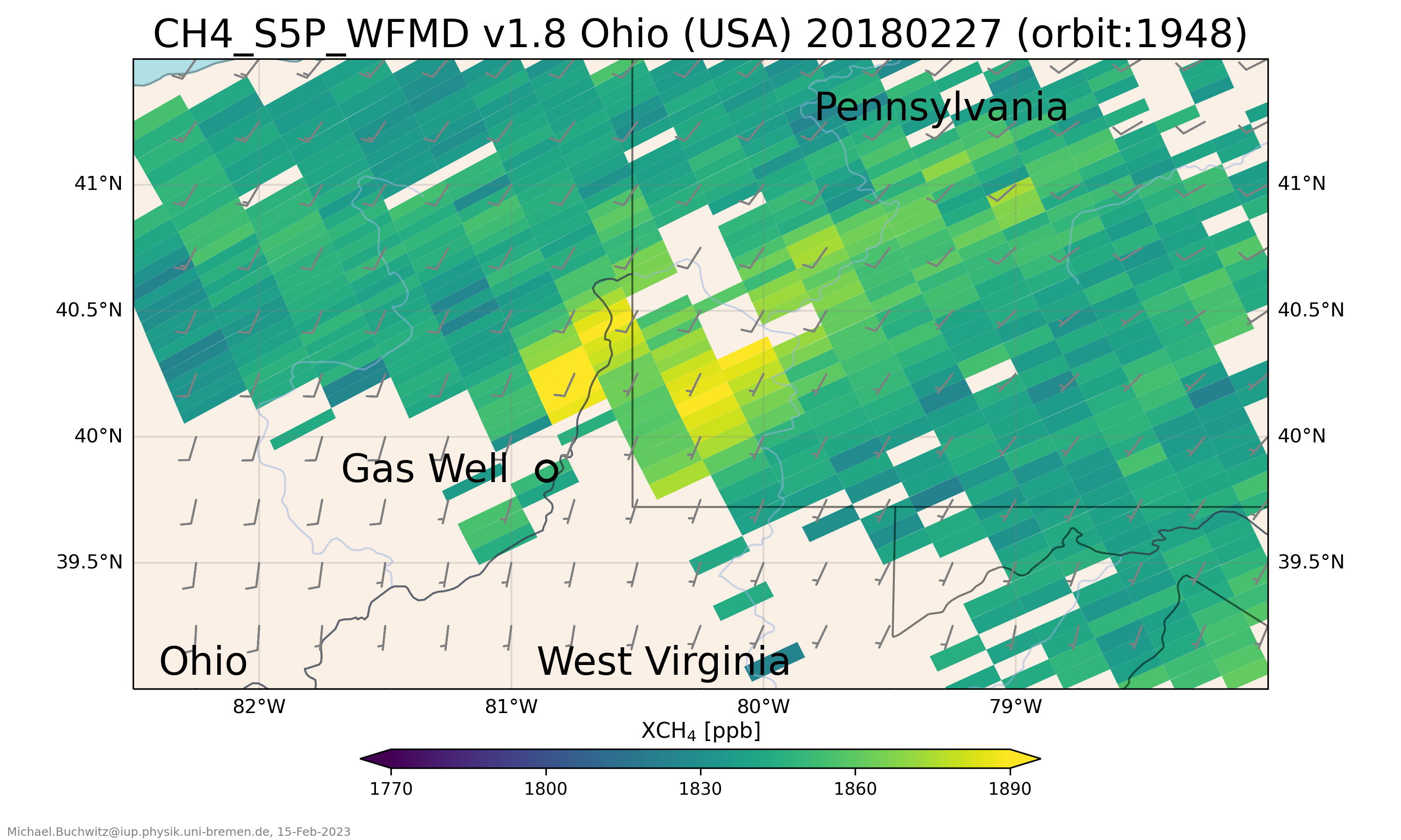
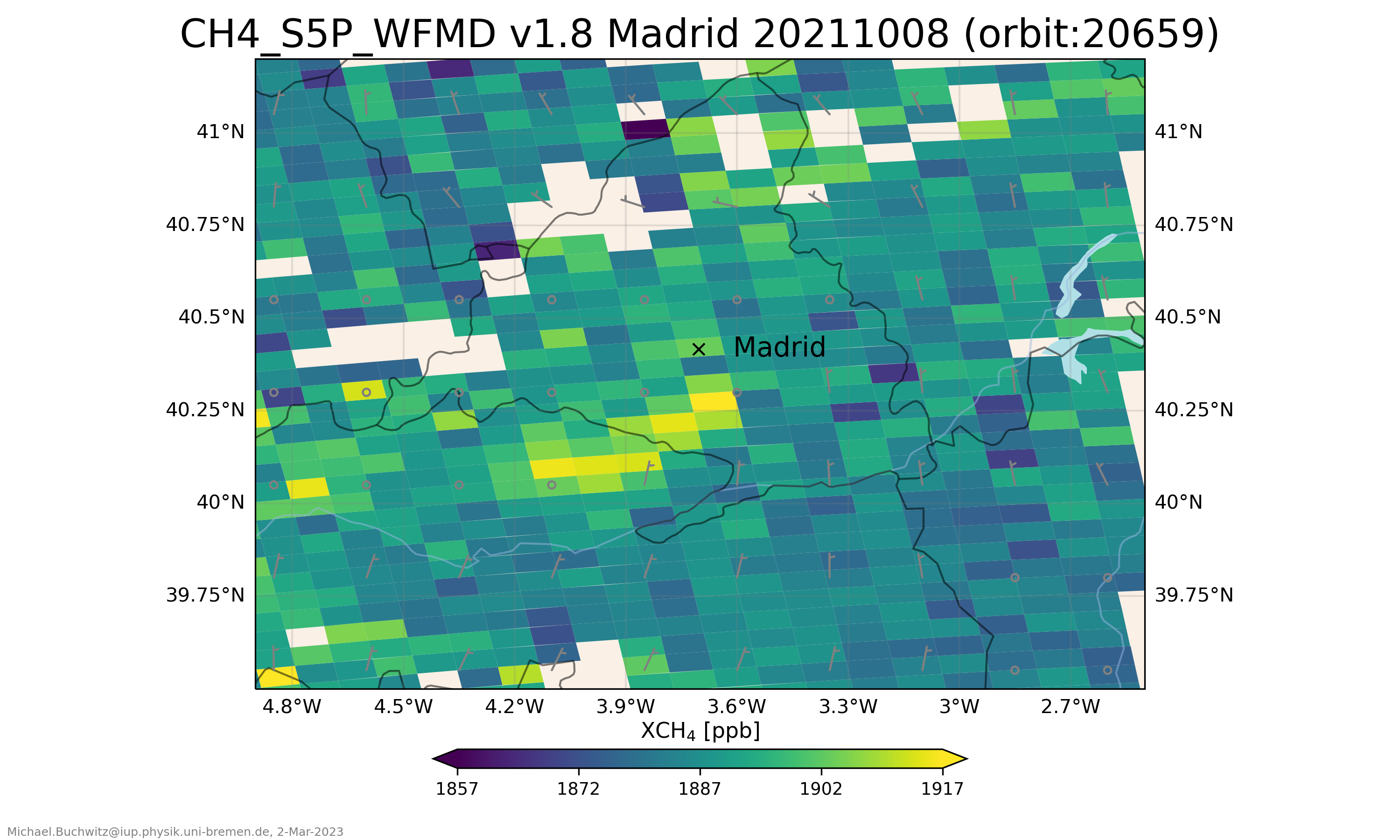
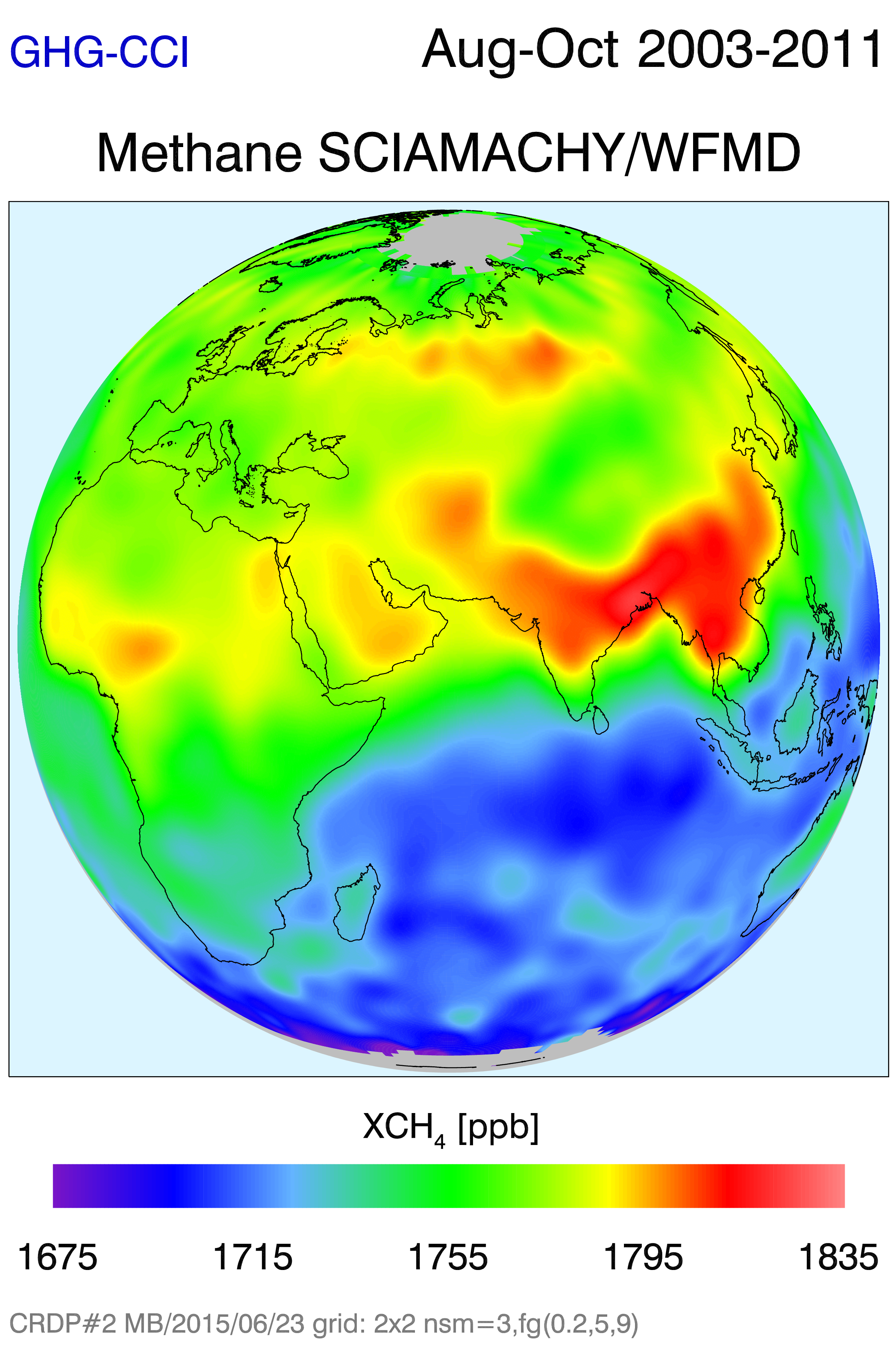
Selected regions with locally elevated methane:
Animation of satellite XCH4:

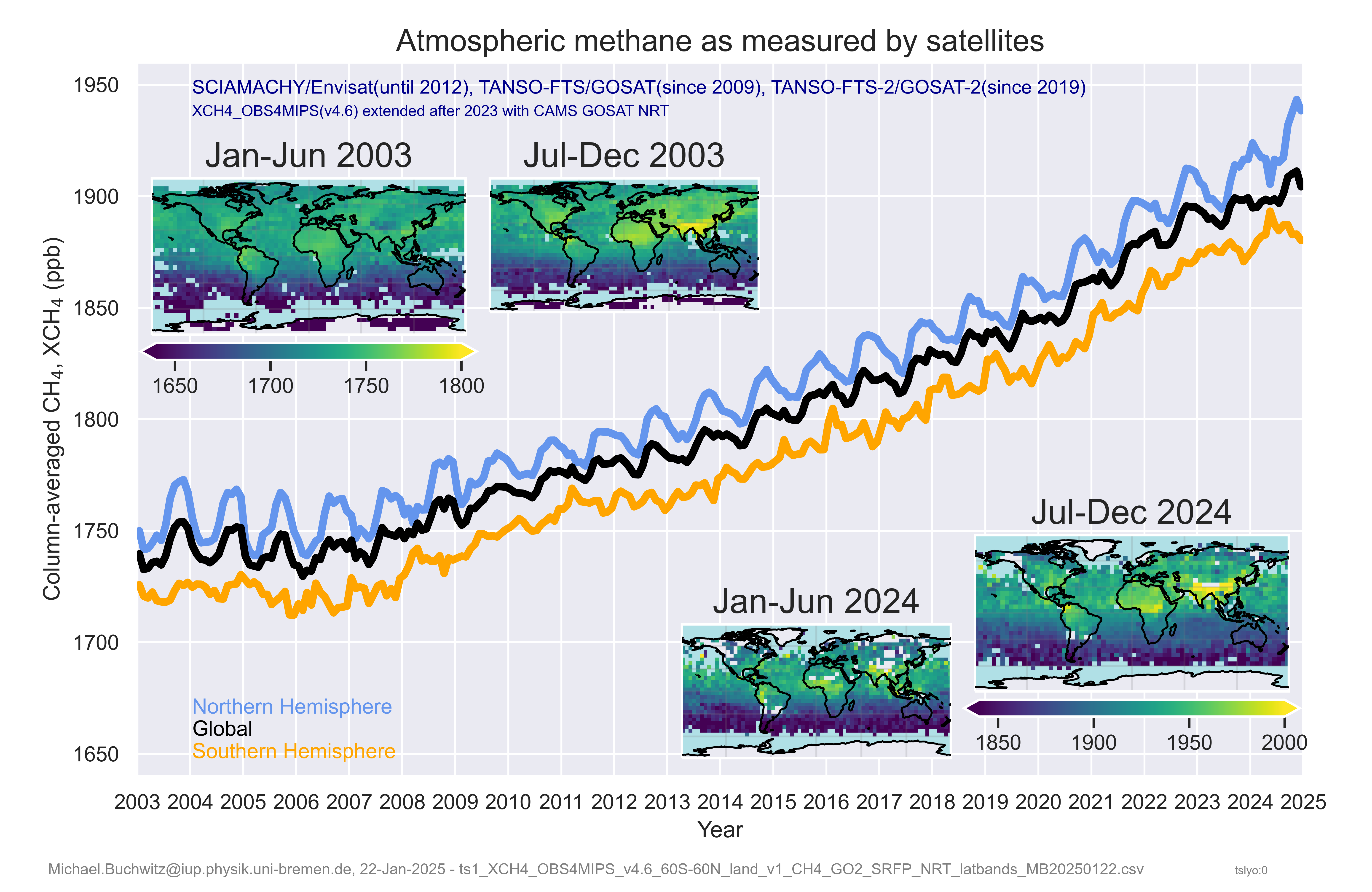
XCH4 maps and time series:
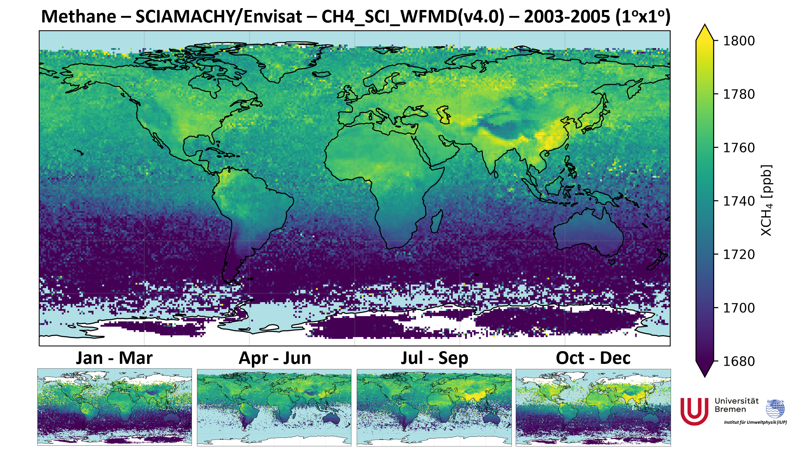
SCIAMACHY XCH4:
Animation of satellite XCO2:

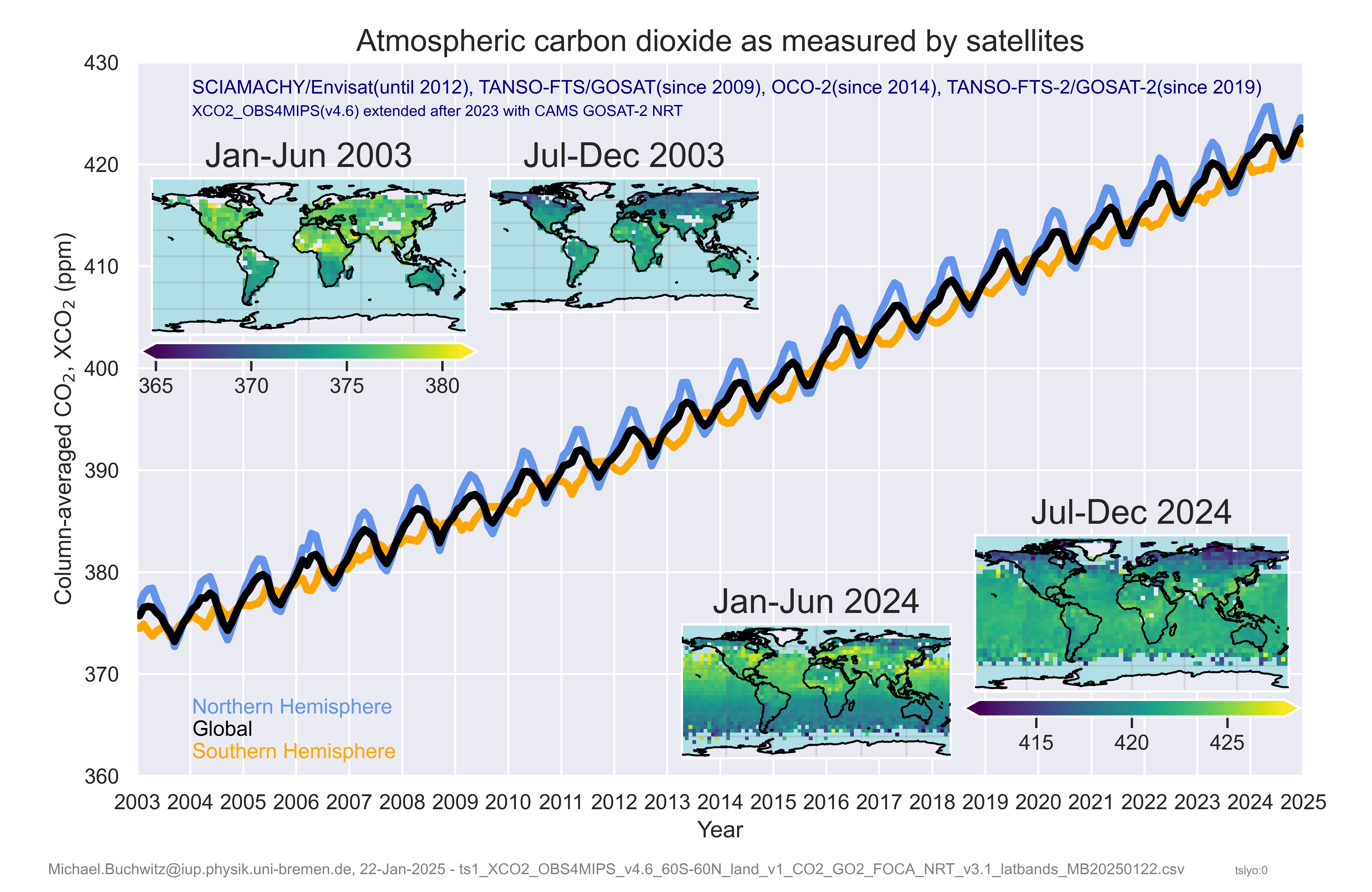
XCO2 maps and time series:
Methane maps SCIAMACHY / WFMD:
Previous/old website: SCIAMACHY CO, CH4 and CO2 images.
TROPOMI-S5P WFMD methane product on PAL website.
Please visit ESA Climate from Space website. Select language, Data Layers (Daten Layers), CH4 oder CO2.
Last modification: 3-Feb-2025
Author: Michael.Buchwitz@iup.physik.uni-bremen.de