
Remote Sensing (Prof. Notholt)
The remote sensing of the atmosphere involves different measurement principles that can be split into active (e.g., lidar) and passive methods. In our group we only deal with passive methods, the absorption and emission spectroscopy in the infrared and microwave spectral range.
In the absorption measurements the sun or moon are used as external light sources, in emission spectroscopy the intrinsic radiation of the atmosphere or earth's surface, e.g. from the sea ice, is measured. The principle of absorption spectroscopy can also be used for in-situ measurements, using an internal light source, to sample locally an air sample. Our measurements are complemented by different model calculations that simulate the composition of the atmosphere and its variability and change.
Research Fields
Remote Sensing of Polar Regions
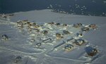
Sea ice is a sensitive climate change indicator as it is reflected in the drastic reduction of the Arctic sea ice cover during recent decades. To observe the remote and vast sea ice areas in the Arctic and Antarctic satellite remote sensing is the method of choice.On this website you find sea ice datasets from satellite remote sensing observations produced at the University of Bremen. All datasets are research products provided without liability.
Contact and more information: Dr. Gunnar Spreen
Remote sensing of atmospheric trace gases in the mid-infrared and millimeterwave region of the spectrum
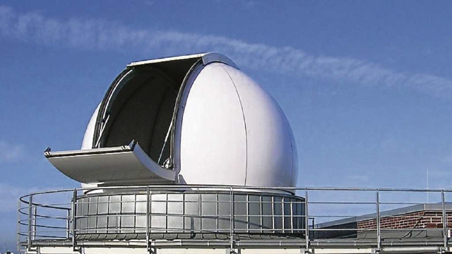
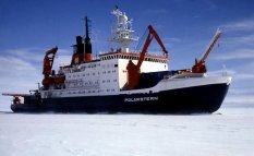
FTIR Spectrometry is used for laboratory and field measurements in the mid-infrared region of the spectrum. Laboratory measurements are done in Bremen. Field measurements are on Spitzbergen (Norway, 79°N, 12°E), in Bremen (Germany, 53°N, 9°E), in Paramaribo (Suriname, 6°N, 55°W) and in Koror (Palau, 7°N,134°E). Measurements are also taken on campaigns, e.g. the research vessel Polarstern.
The measurements are used to monitor chemistry related to the Ozone layer in the stratosphere, but also pollution. Measurements in the millimeterwave region of the spectrum are used to observe chemical and dynamical processes in the Stratosphere and Mesosphere. Measurements in Spitsbergen, Suriname, Palau and on the Polarstern are done in close cooperation with the AWI Bremerhaven.
Contact and more information: Dr. Mathias Palm
Near-IR remote sensing and in situ measurements
The aim of this group is to contribute to the better characterisation of the sources and sinks of greenhouse gases (GHGs). Remote sensing and in situ measurements of atmospheric GHG concentrations are performed at the sites Ny Alesund (Spitsbergen), Bremen (Germany), Orleans (France), Nicosia (Cyprus), Paramaribo (Suriname) and on the research vessel Polarstern. These data is used for inverse modeling as well as for satellite validation. In addition GHG fluxes between the biosphere and the atmosphere are measured in the Amazonian rain forest in Brazil and the carbon and nitrogen cycles are investigated in peat draining rivers in Malaysia and Brunei.
Contact and more information: Prof. Dr. Thorsten Warneke
Junior Research Group: Greenhouse Gases in the Arctic
Closely associated with the near-infared and mid-infrared working groups in the atmospheric remote sensing department, we investigate greenhouse gases in the Arctic with a special focus on methane. We use ground-based Fourier-Transform spectrometers measuring in the near- and mid-infrared spectral region in solar and lunar absorption and atmospheric emission geometry at the AWIPEV station in Ny-Ålesund, Svalbard.
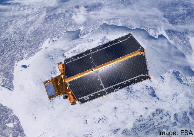
Recently, satellites like the TROPOMI on Sentinel-5P offer methane products with high spatial resolution and good coverage. Together with the Carbon-GHG group at the department of Atmospheric Chemistry and Physics we investigate the distribution and evolution of trace gases in the Arctic.
Contact and further information: Dr. Matthias Buschmann
Lectures / Publications / Staff
- Information about lectures can be found under Lectures and Seminars.
- Peer-reviewed publications of the Remote Sensing group:
- 2025 - 2024 - 2023 - 2022 - 2021 - 2020 - 2019 - 2018 - 2017 - 2016 - 2015 - 2014 - 2013
- Publications Archive
- Members of the Remote Sensing Group
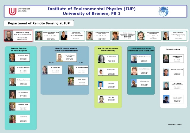
- The structure of the remote sensing section can be seen from the following diagram: [2.661 KB]